The dream of building a memorial to the vanished village of Babiny I began its life in the autumn days of 2024 in connection with the decision to renovate the Babiny I cross. Here it is necessary to clarify the names used: the extinct village was called Babiny I, not far from it, across the valley of the Homole stream, there is a settlement called Babiny II, which is now part of the village of Homole u Panny. In the Inventory of the association, for simplicity and clarity of the names of small sacral monuments (SSM), each of the 10 parts of the village of Malečov is listed in Roman numeral order after the documented SSM. So the name of the SSM Babiny I is actually the first documented cross in the Babiny I part. Otherwise this SSM would have to be listed in the Inventory as Babiny I I, the second one as Babiny I II, etc.
Thus, in the first phase of this project, the Babiny I cross will be renovated first. The progress of its renovation can be followed HERE.
In the second stage, a resting place will be built at the well (see photos behind the historical images in the Photo Gallery section), where an information sign will be installed, which will have a special QR code in addition to text about the history of the village and historical photos. By scanning this code with a mobile phone, the visitor will be able to be transported to a 3D model of the village indicated by the simplified shapes of semi-transparent buildings placed in the existing real landscape.
In order to create a 3D model, a discussion was initiated in early December 2024 with Pavel Matoušek from Ústí nad Labem, who has already created several 3D models for the association - see, for example, the renovation of the statue of St. John of Nepomuk in Proboštov.
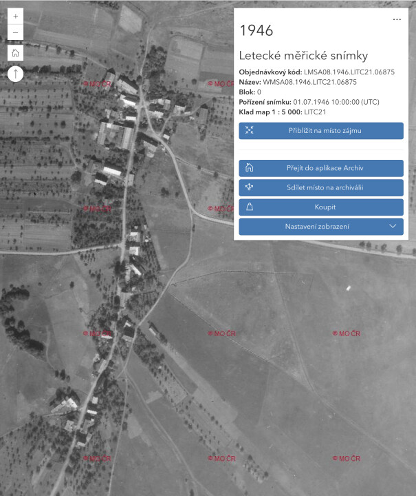
At a personal meeting on 13 December 2024, further procedures and details were already agreed. Pavel Matoušek will use a drone to create a 3D model of the existing landscape of the vanished village of Babiny I in the period when the trees are without leaves. Based on input from the chairman of the association, he will then place the buildings visible on the 1946 aerial survey into this landscape, when the village was still in good condition after the removal/expulsion of the Germans. The semi-transparent buildings of simple shapes will help to give an idea of the structure of the village, the size and location of the individual buildings.
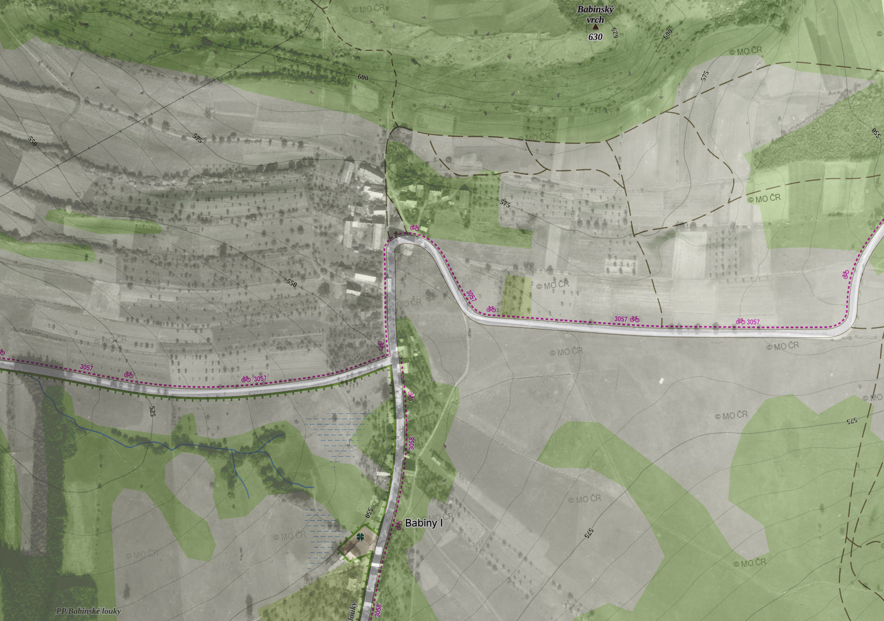
On 16 December 2024, the graphic studio Imagine Media, based on the request of the association, created a basis for specifying the location of the buildings in the existing landscape by projecting an aerial image onto today's map.cz, from which the coordinates for their placement in the 3D landscape model will be subsequently determined.