By:
Chapters 1, 2, 5, 7, 9 by Tereza Pařezová, Aneta Zimandlová, students of the xth year of the Department of History, Faculty of Humanities, UJEP Ústí nad Labem, May 2024 (Seminar work under the supervision of Mgr. Vilém Zábranský, Ph.D.)
1. Location
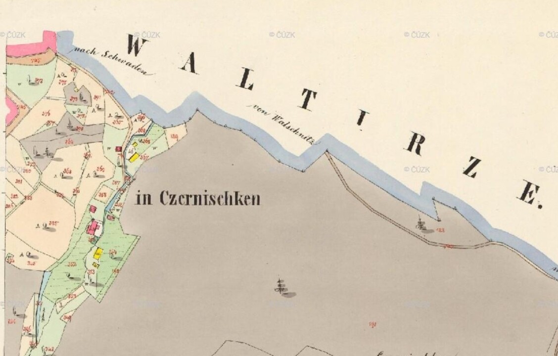
The settlement was located at an altitude of 253 m above sea level. It stood approximately halfway between the villages of Březí and Olešnice, in the gorge of the Olešnický (Černý, Čeničský) brook. To the southwest of Černičky is the Varta hill, whose top reaches 379.6 m above sea level and was formerly the site of a Gothic castle, last mentioned in 1456.[1]
The exact location of all ZOOS in geographical coordinates is given in the Map section.
2. History
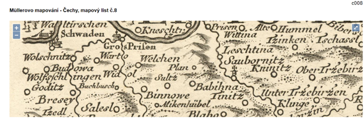
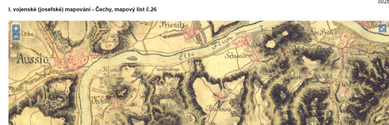
The origin dates back to the early modern period, i.e., to the turn of the 16th and 17th centuries. The first documented record of the existence of the settlement is a civil registration from January 9, 1696, when Anna Maria Stroppe was baptized here. Even from an earlier time, around 1650, we know the names of local millers—Stroppe, Kompach, and Jakobitz.[2] Another mention can be found in the Imperial Mandatory Prints of the Stable Cadastre of Bohemia from 1843. The last specific reference, naming Maria Pecher as one of the owners, dates back to 1921. The settlement is often found under Germanized names—Tschernischken, Czernischken.[3] From 1950, Černičky became part of the municipality of Březí. At that time, there was supposedly only one inhabited house.[4]
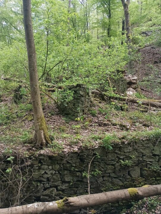
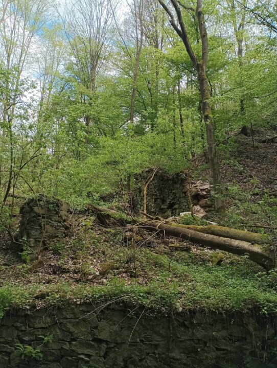
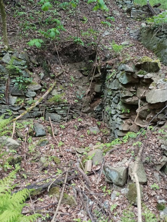
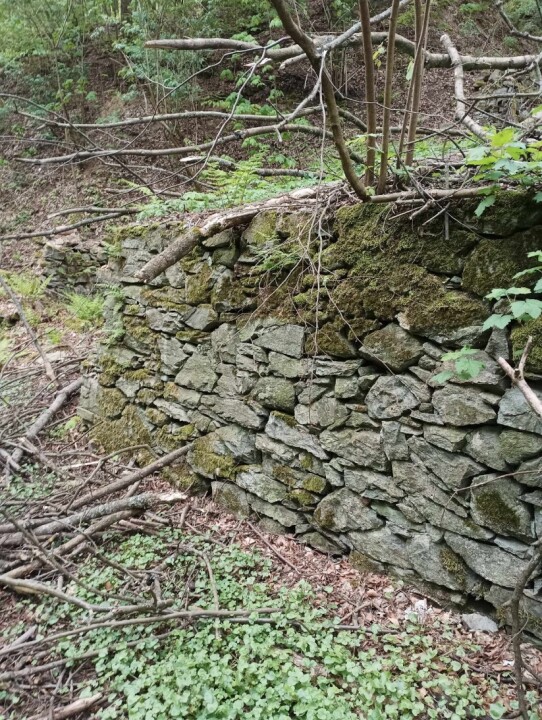
Černičky included about three to four homesteads, although some sources state that there may have been as many as six. All the buildings were situated on both sides of the stream and were farm-type structures. There were houses numbered 40, 41, 45, and 46, mills numbered 42 and 43, and the grove house, reportedly last occupied in 1952. Additionally, the village consisted of gardens, two water reservoirs, and orchards, which can be documented thanks to the preserved foundations of fruit dryers. The remains of the mill are preserved as the torso of stone walls and a cellar. Other fragments include remnants of the embankment, a cobblestone bridge, and visible modifications of the riverbed. There are two access roads—both stone, but difficult to navigate in bad weather and winter. Černičky was never electrified.[5]
After World War II, the local German population was displaced. Along with the displacement, the village gradually became depopulated. Although two newly arrived families settled here after 1945, they reportedly moved away again soon after. According to the chronicle of the Březí Municipal Council, there were three inhabited houses here after 1945, and only one in 1950. According to eyewitness accounts, in 1952 only the grove was occupied.[6]
Nowadays, it is a completely extinct settlement with ruins in the middle of a forest. The remains of the mill are visible as the torso of stone walls and a cellar.[7] Additionally, remnants of the mill embankment, a paved bridge, and visible modifications of the stream bed can still be seen.
3. Historical Documents
- - -
4. Legends
- - -
5. Topography
- - -
6. Historical Maps