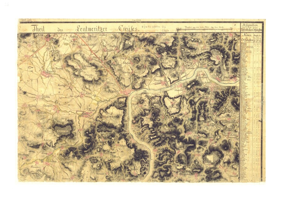
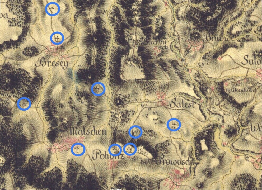
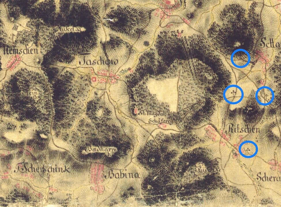
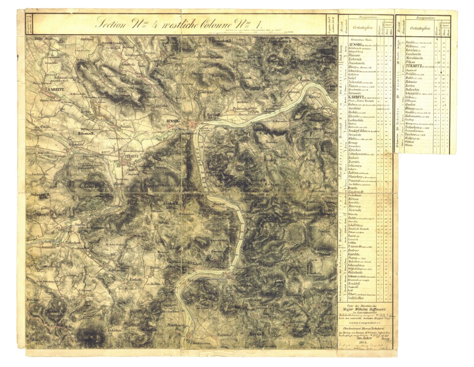
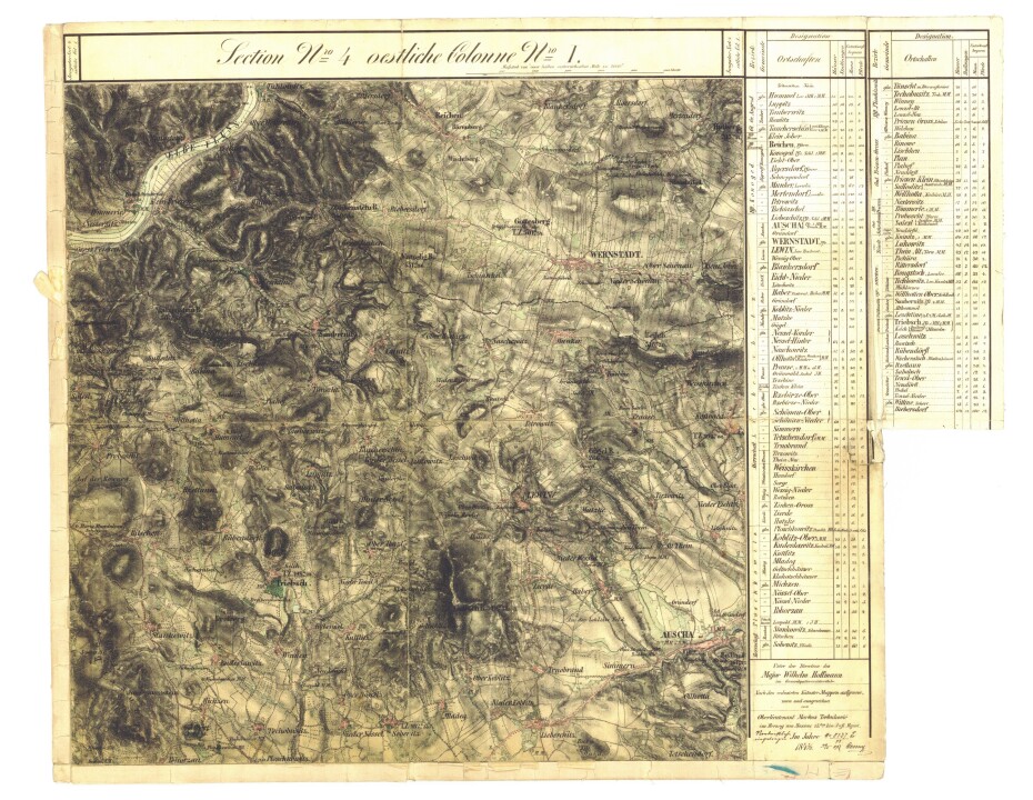
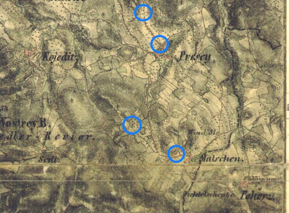
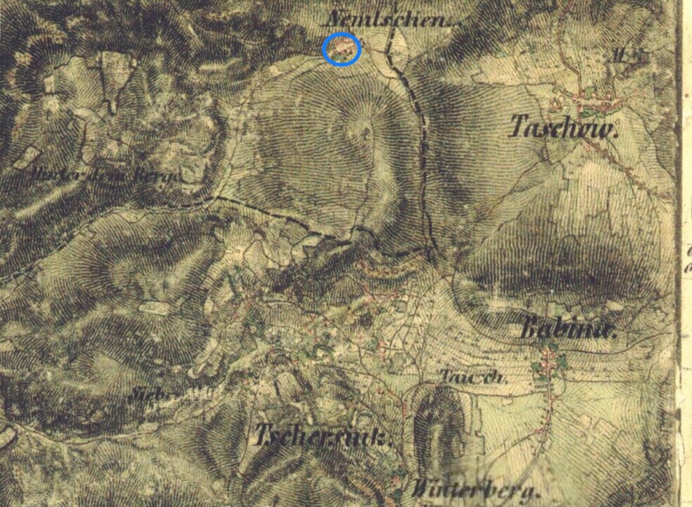
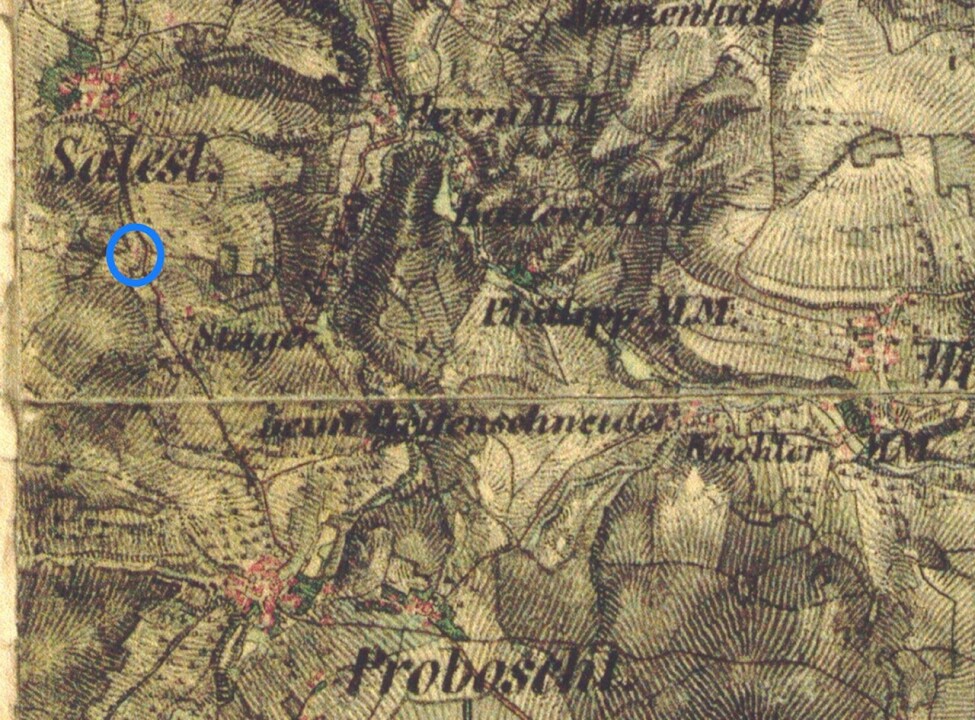
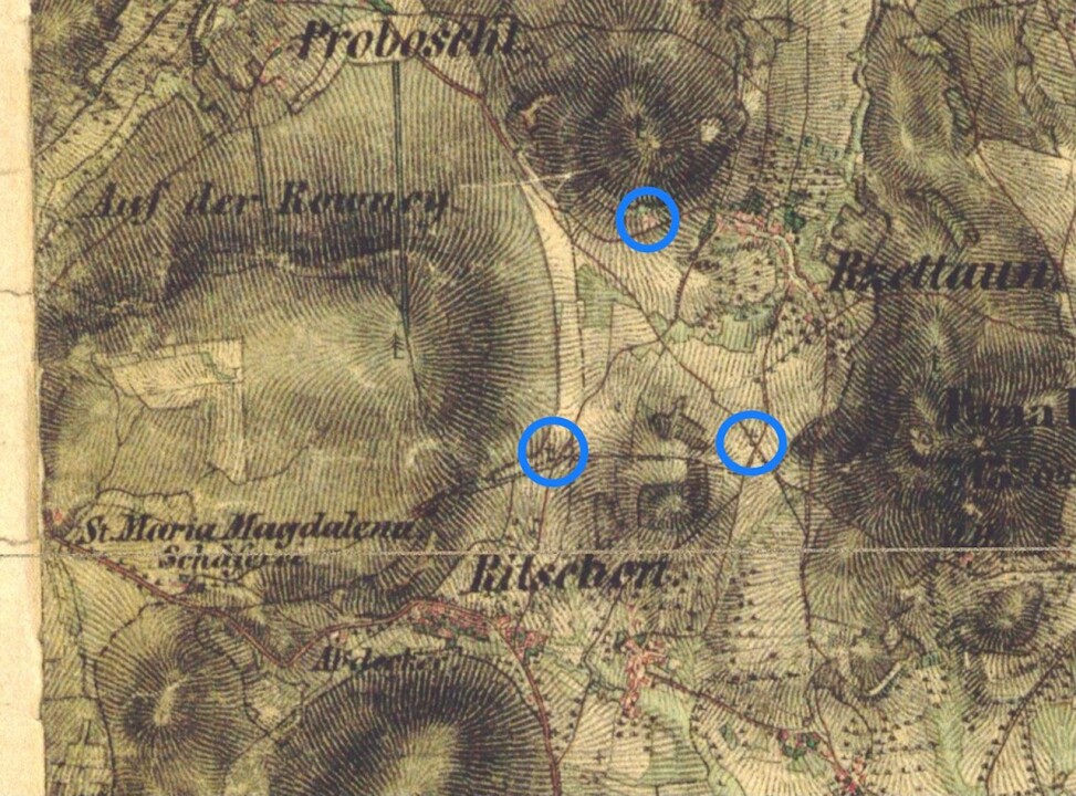
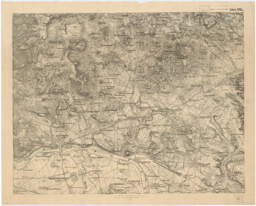
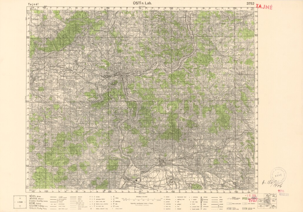
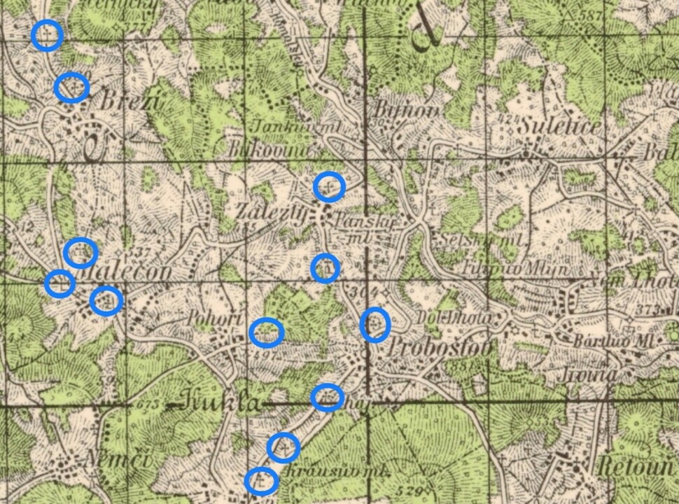
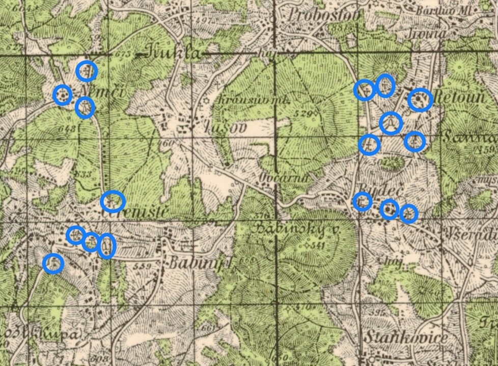
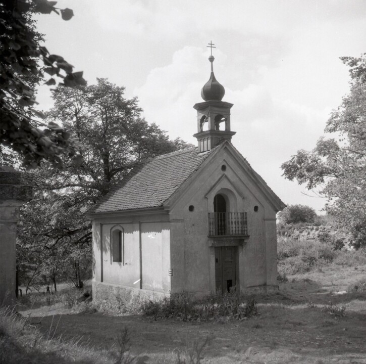
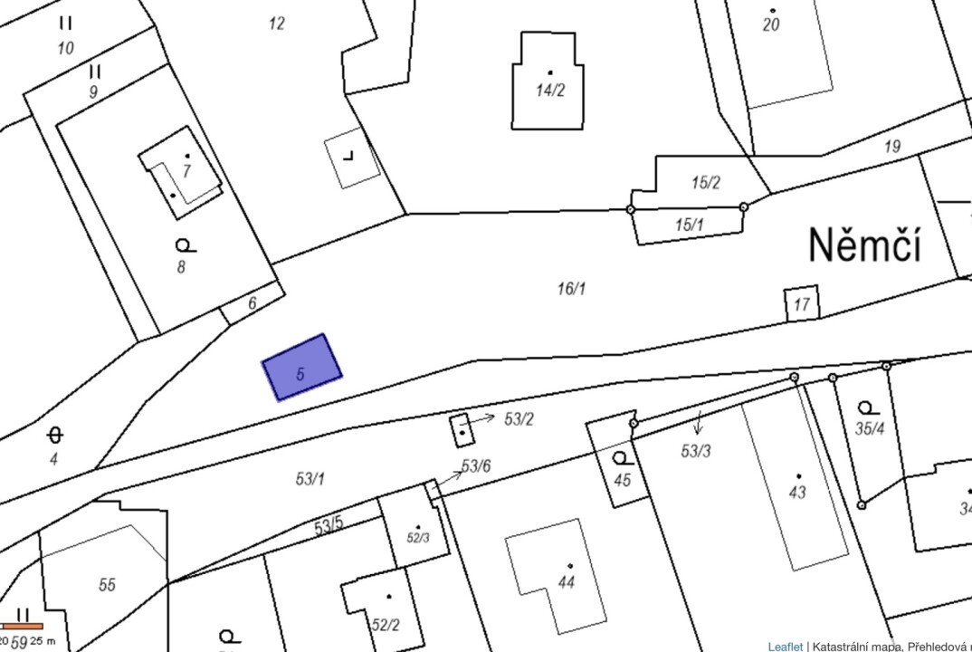
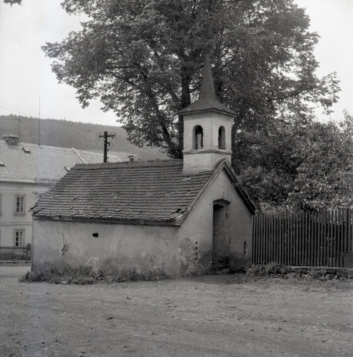
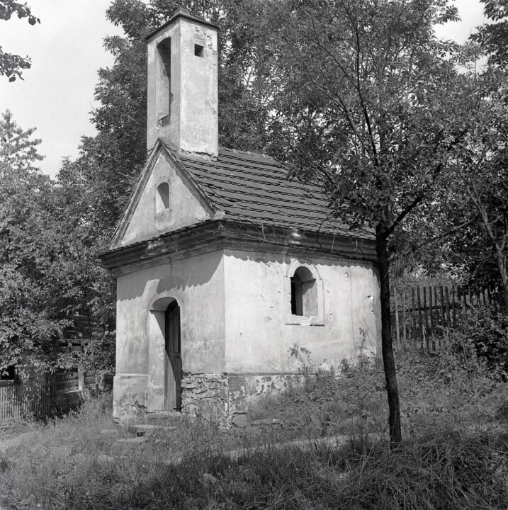
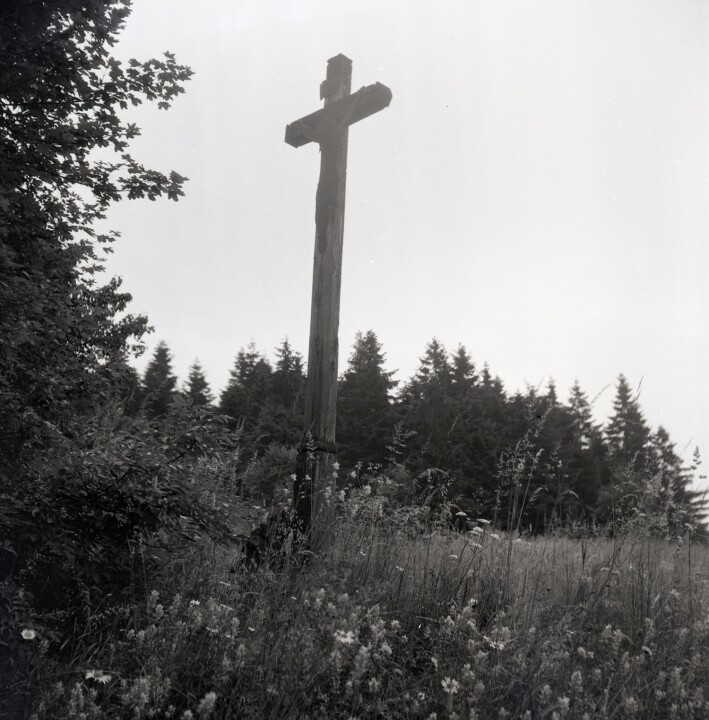
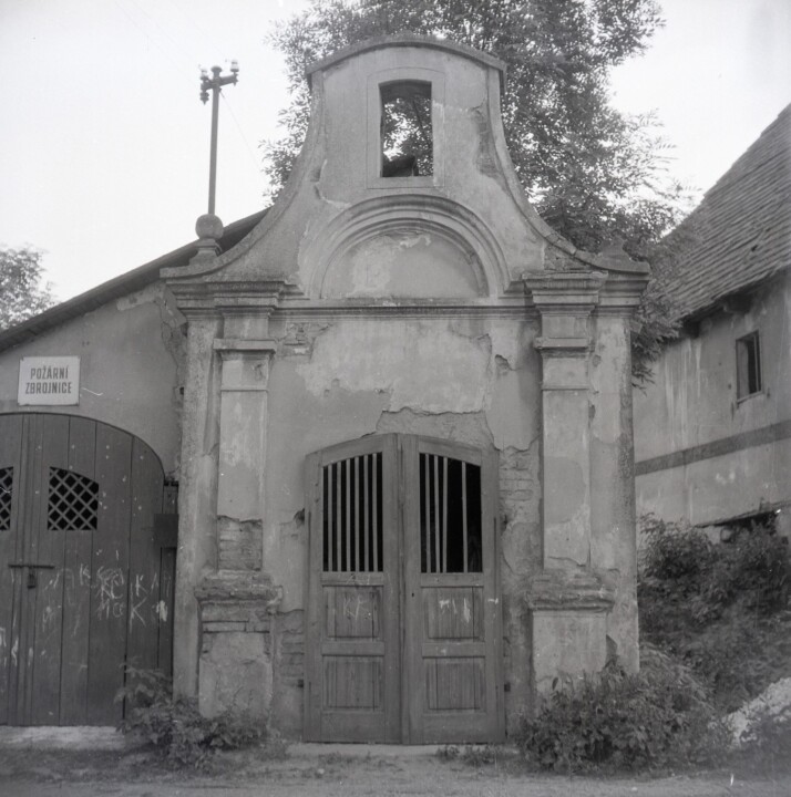
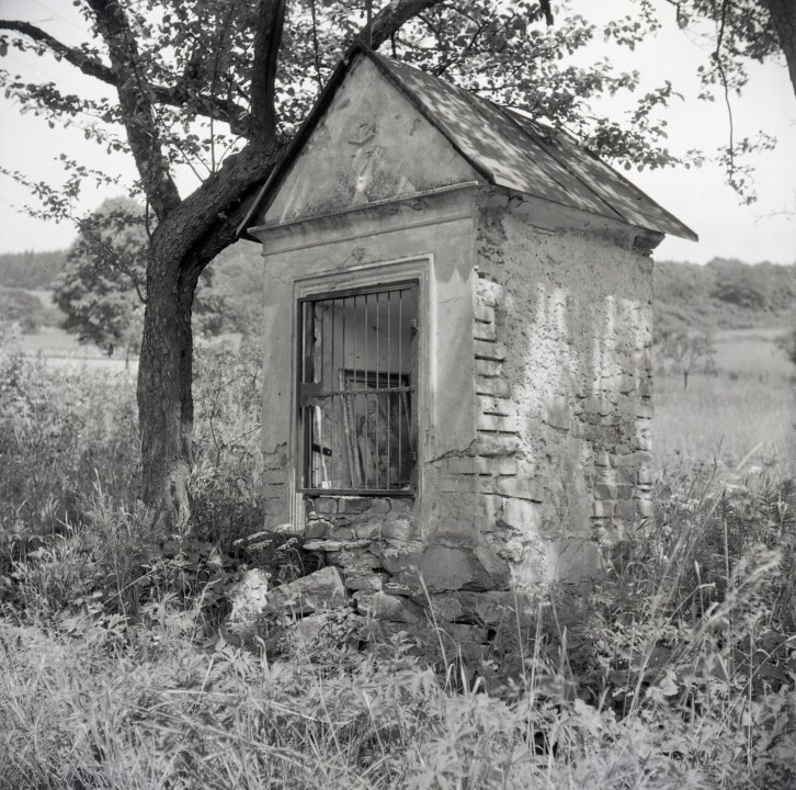
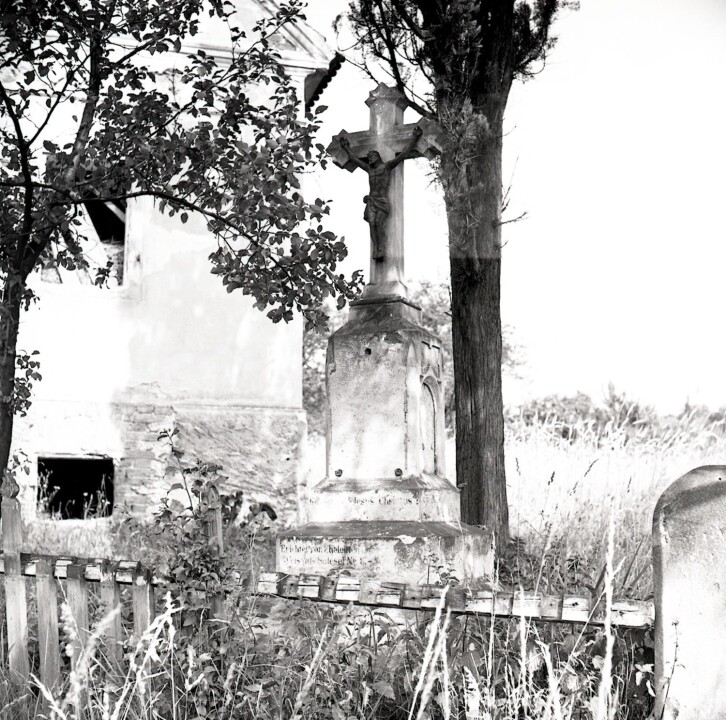
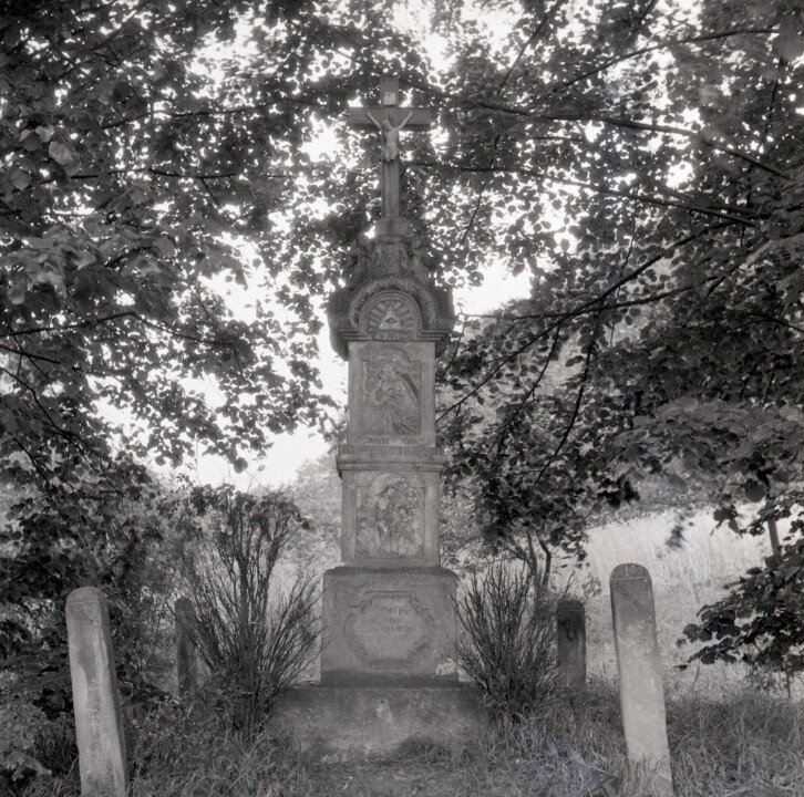
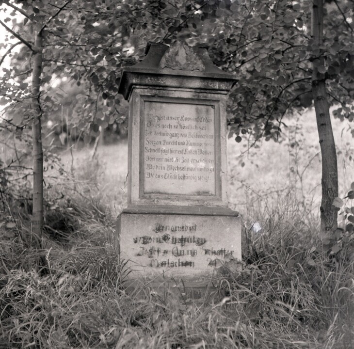
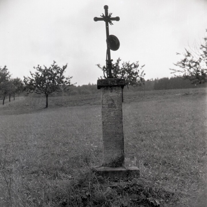
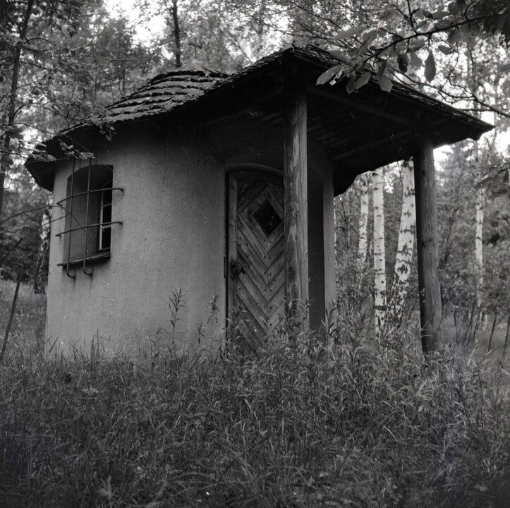
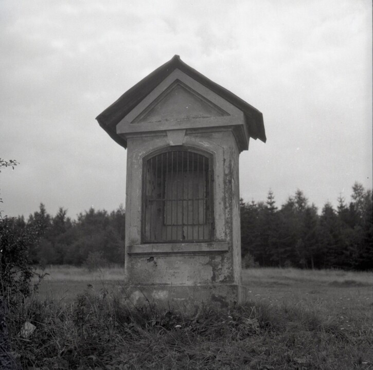
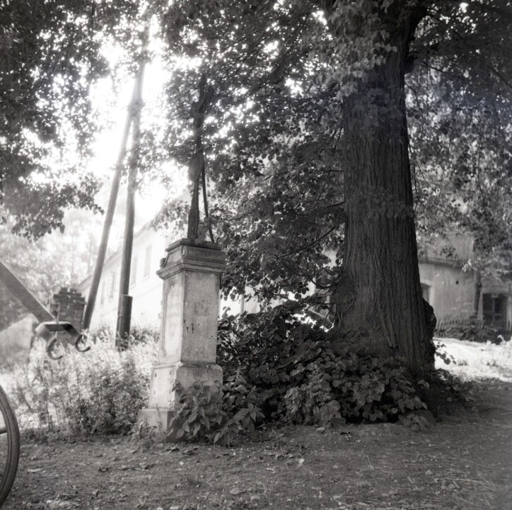
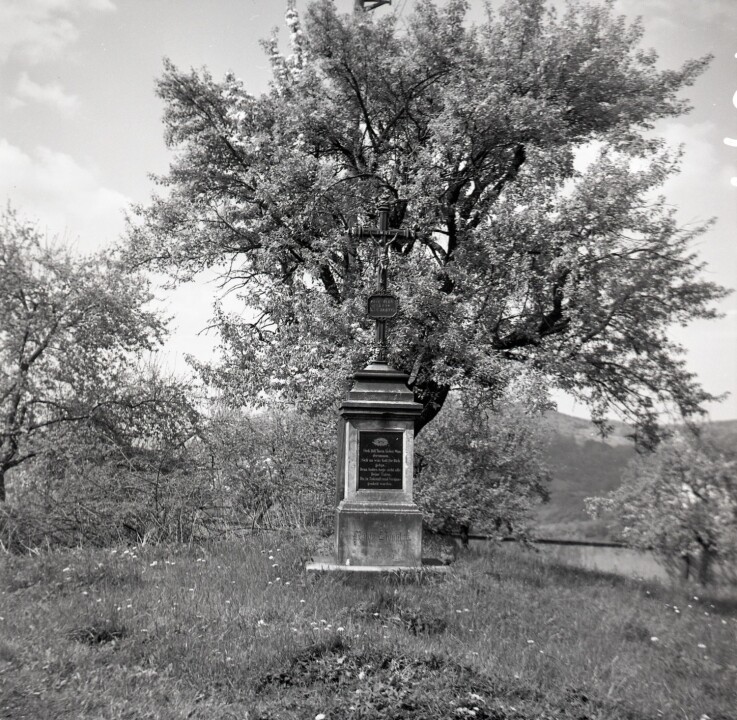
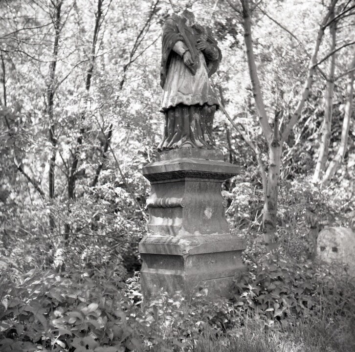
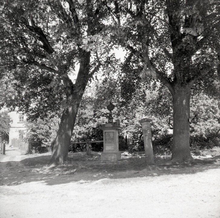
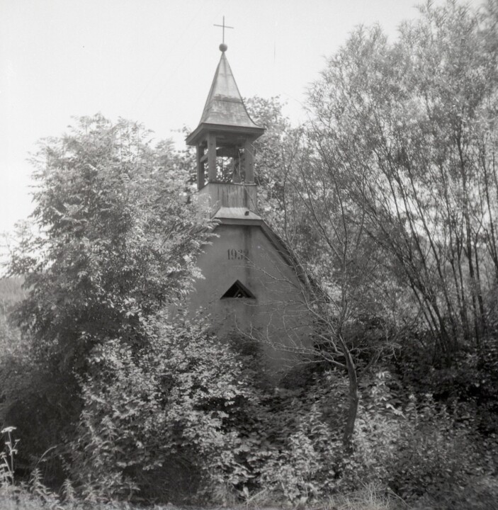
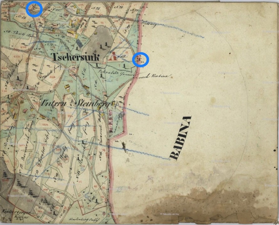
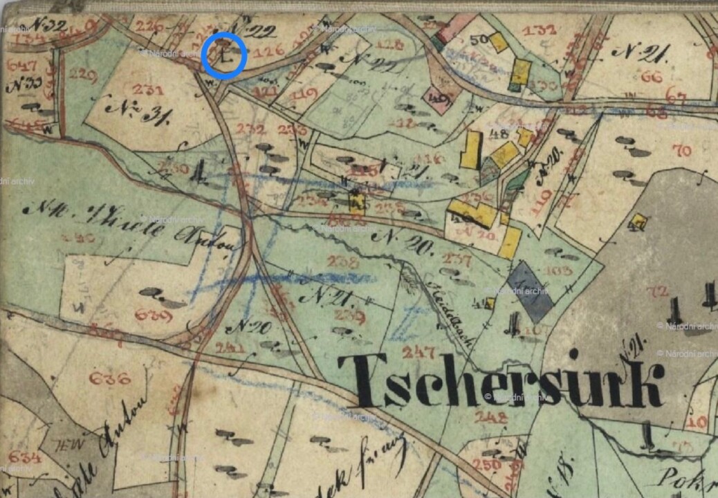
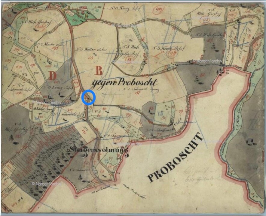
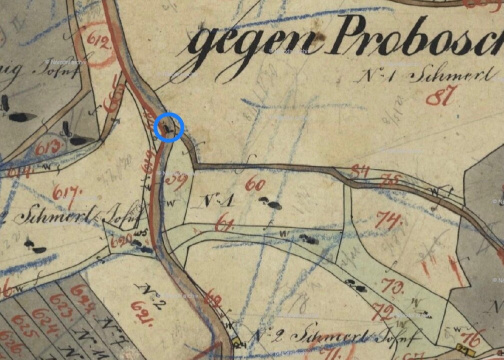
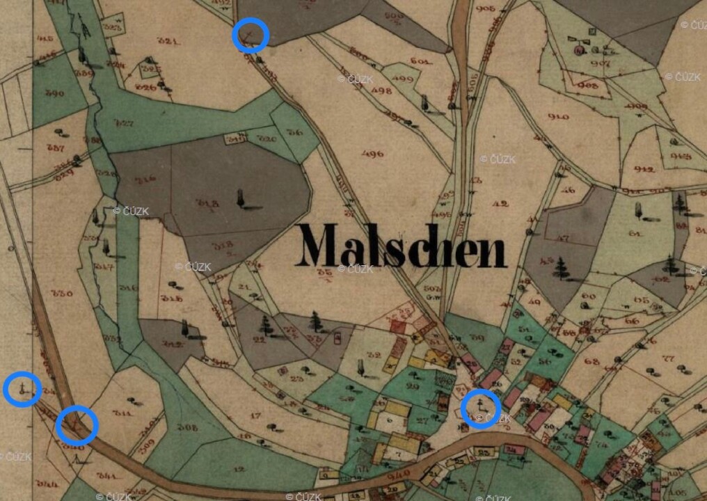
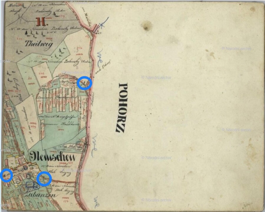
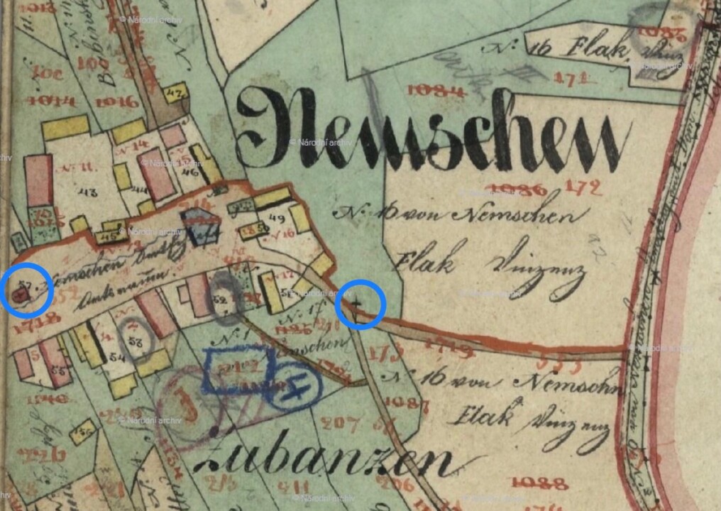
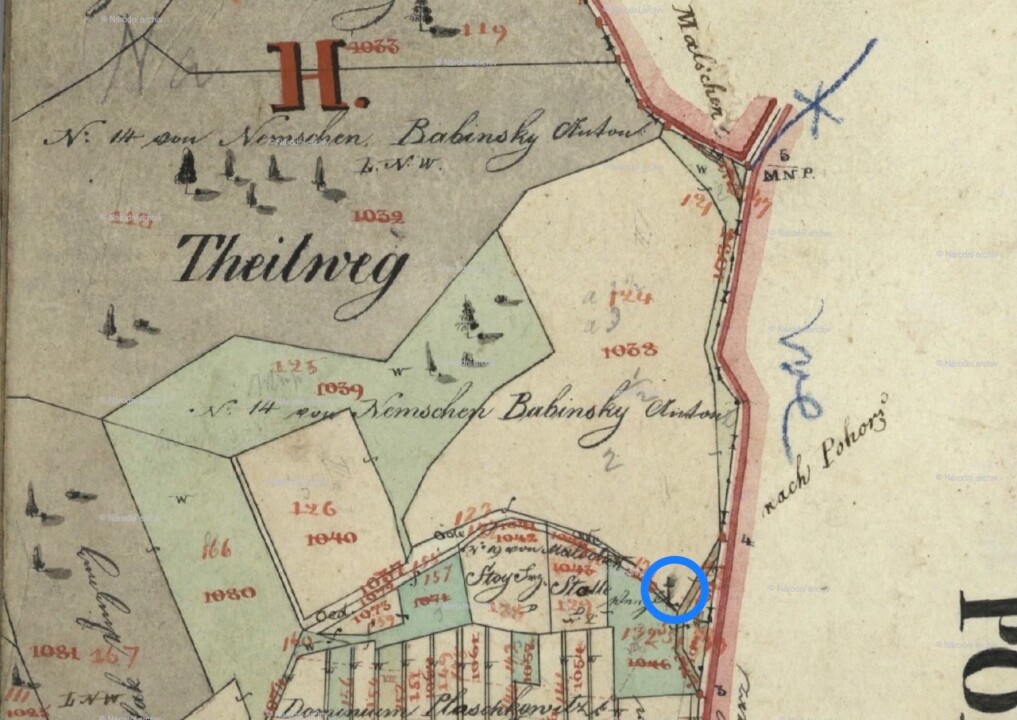
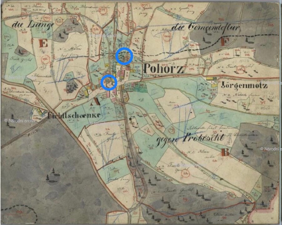
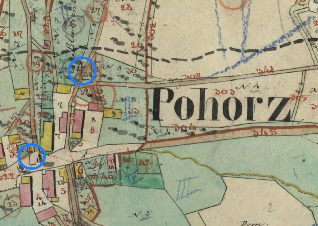
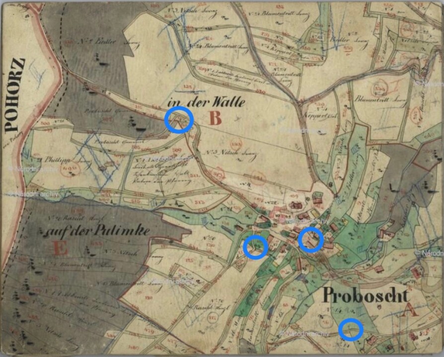
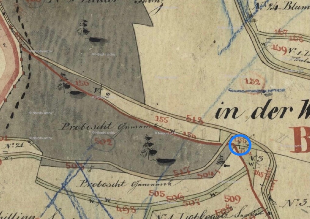
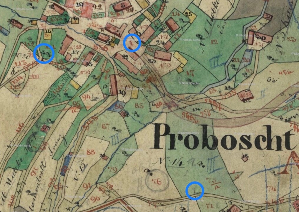
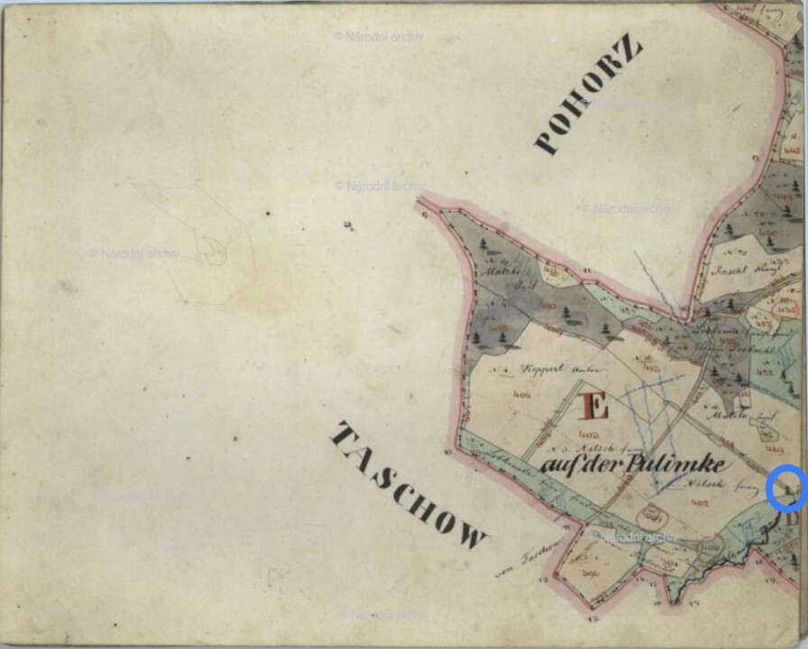
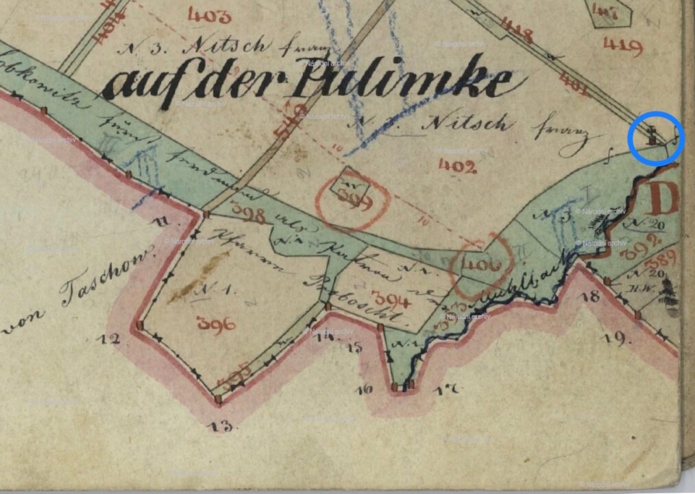
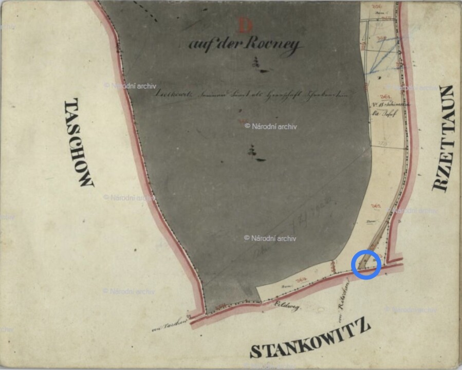
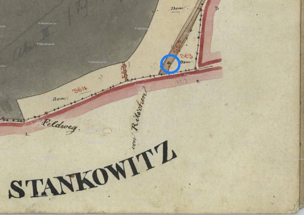
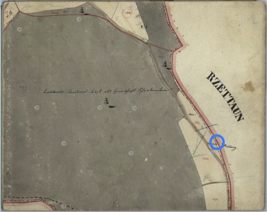
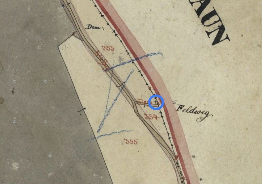
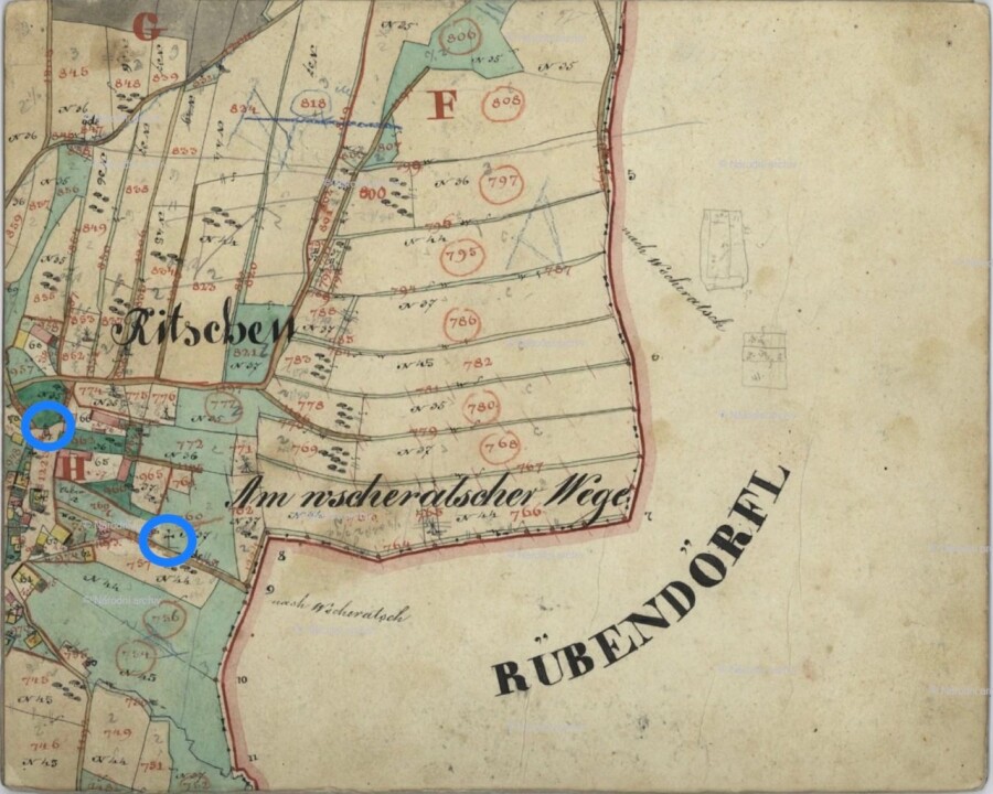
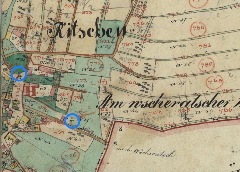
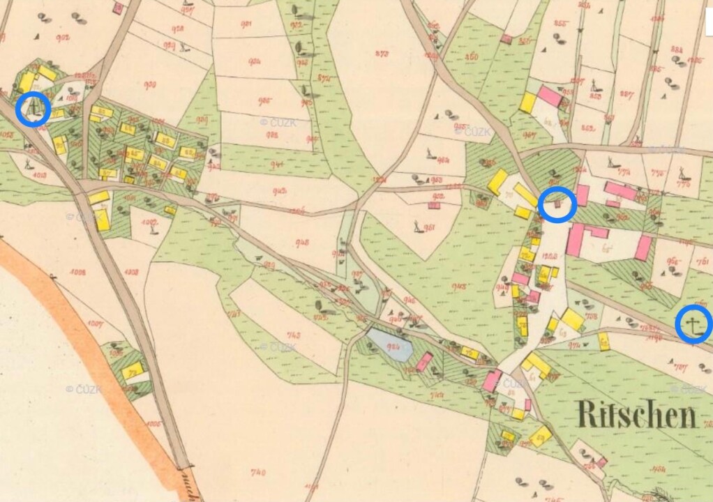
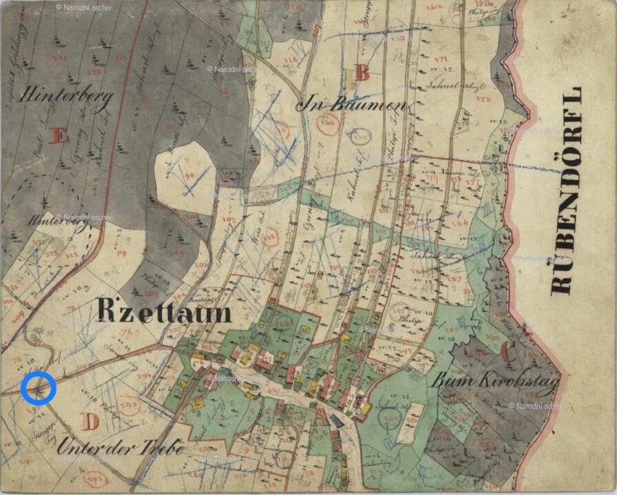
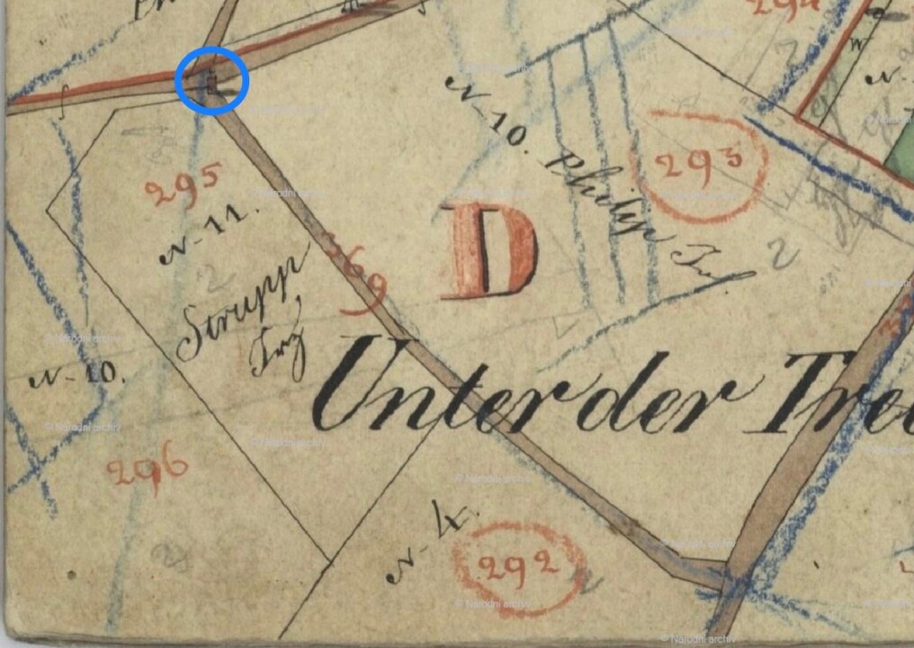
This part of the project focuses on capturing historical documents for mapping and documenting small sacral monuments in the Malečov region. These documents may help determine their location, founder, and time of origin and provide insights into their form if they have not survived or only partially remain. According to the certified Methodology for the Documentation of Small Monuments, small sacral monuments include crosses, wayside shrines, niche chapels, and sculptural monuments. Chapels that can be entered are no longer considered small sacral monuments, yet they also receive well-deserved attention. The Methodology for the Documentation of Small Monuments (hereinafter referred to as the Methodology) was developed by a team of authors: Petr Hrubý, Eva Altová, and Antonín Kadlec, and published in 2015 by the National Heritage Institute, ÚOP Ústí nad Labem, together with the Faculty of Arts, UJEP Ústí nad Labem. The Malečov region is further specified in the ABOUT US section.

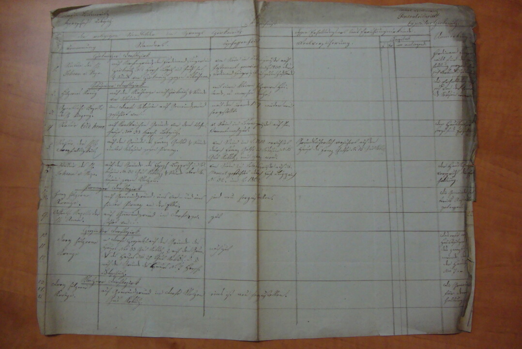
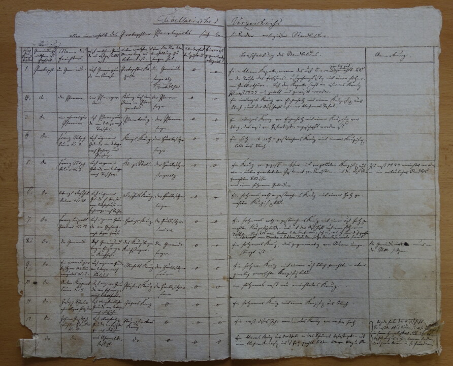
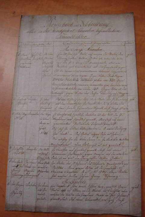
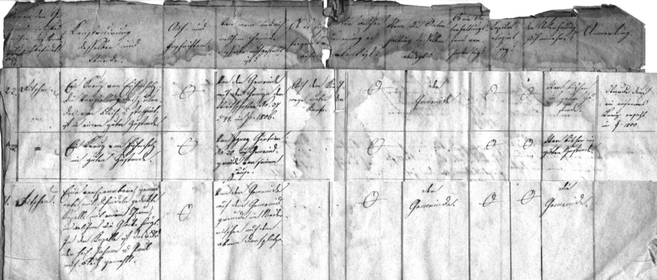
Parish Office Inventories

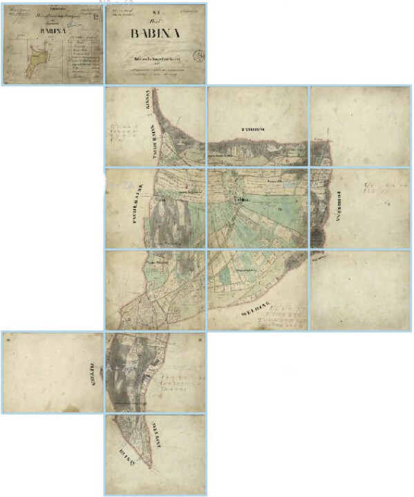
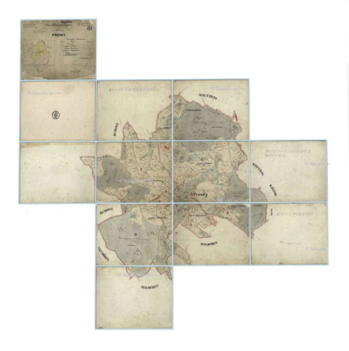
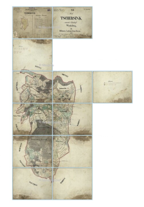
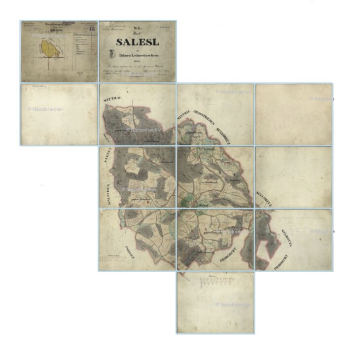
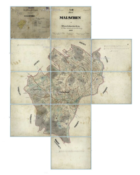
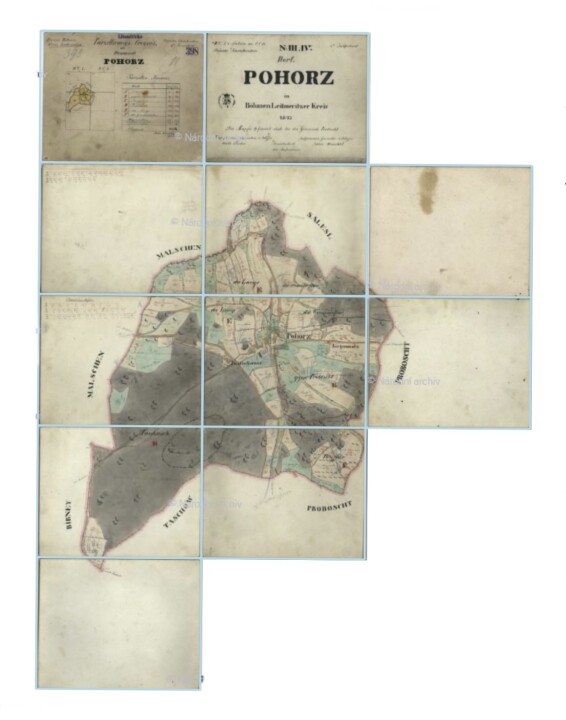
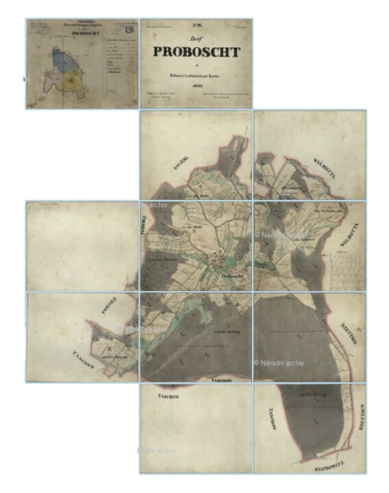
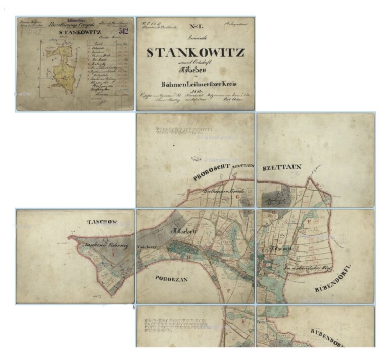
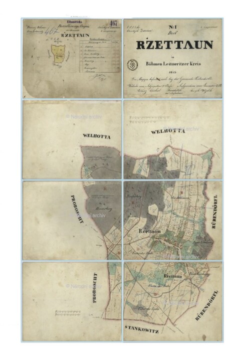
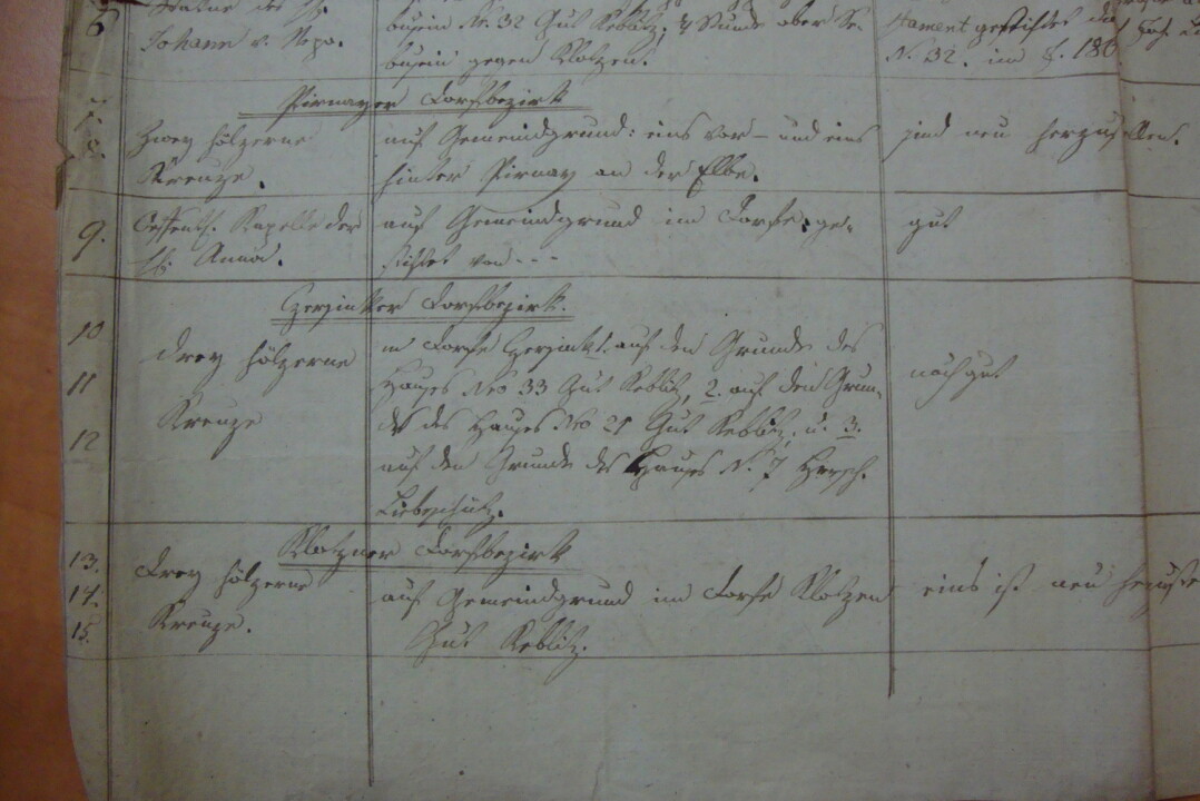
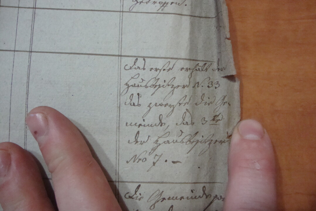
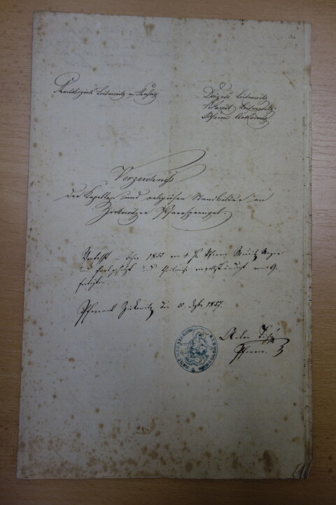
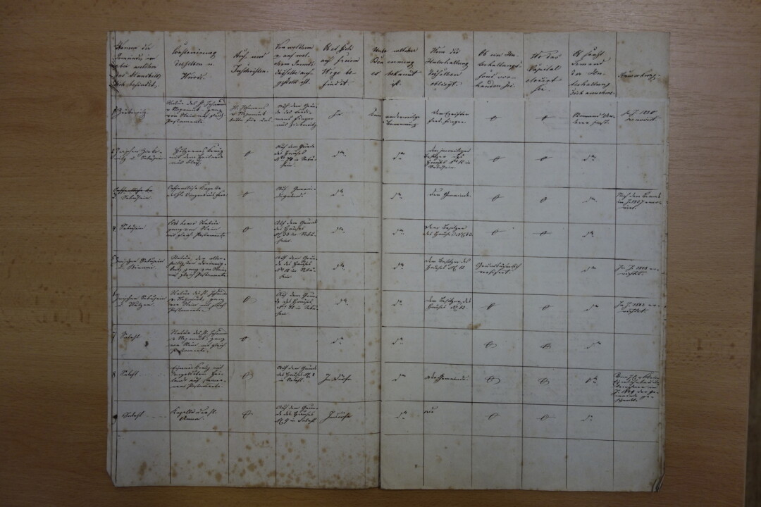
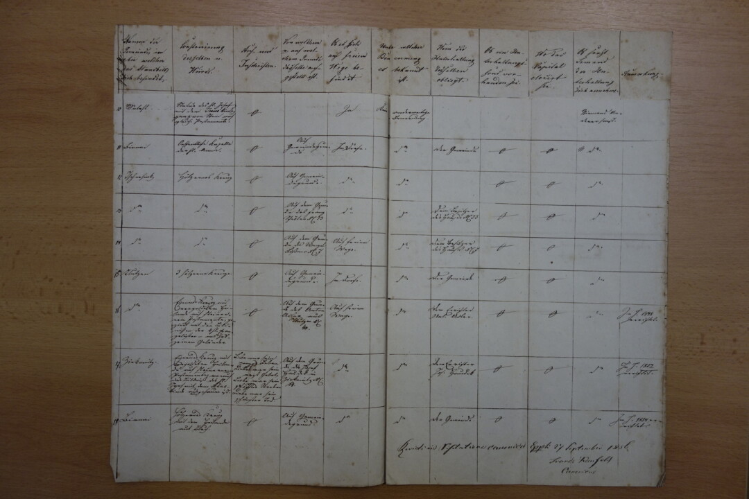
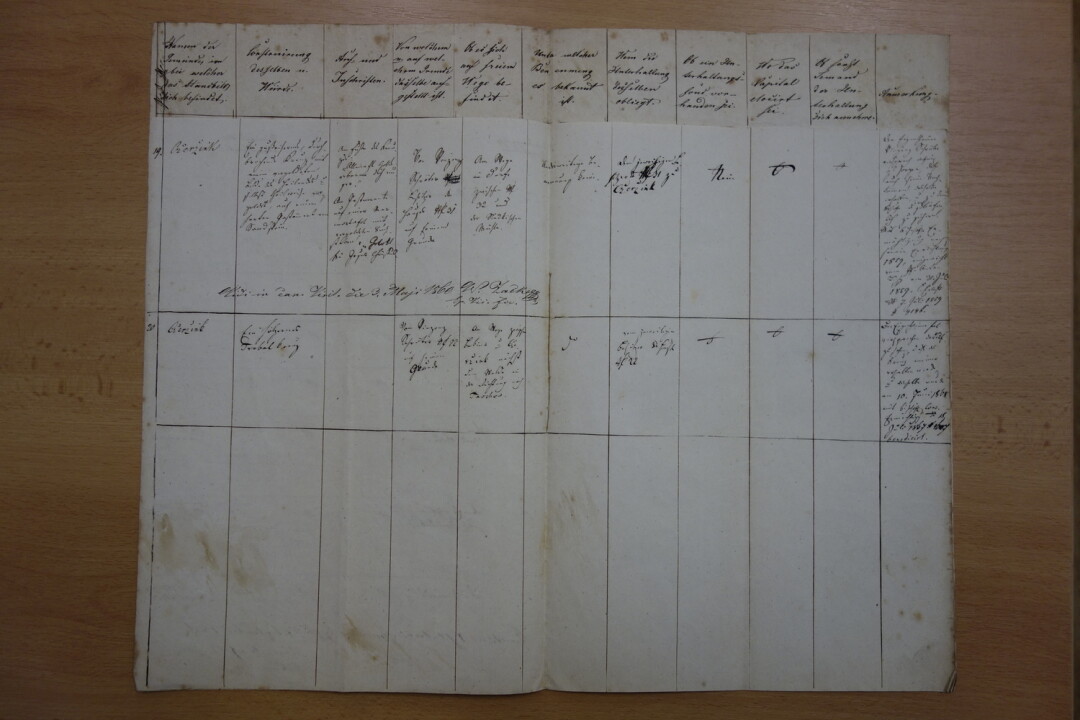
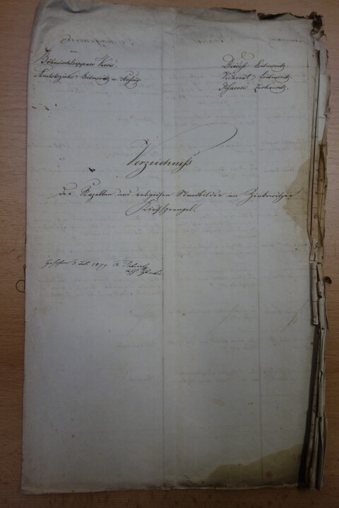
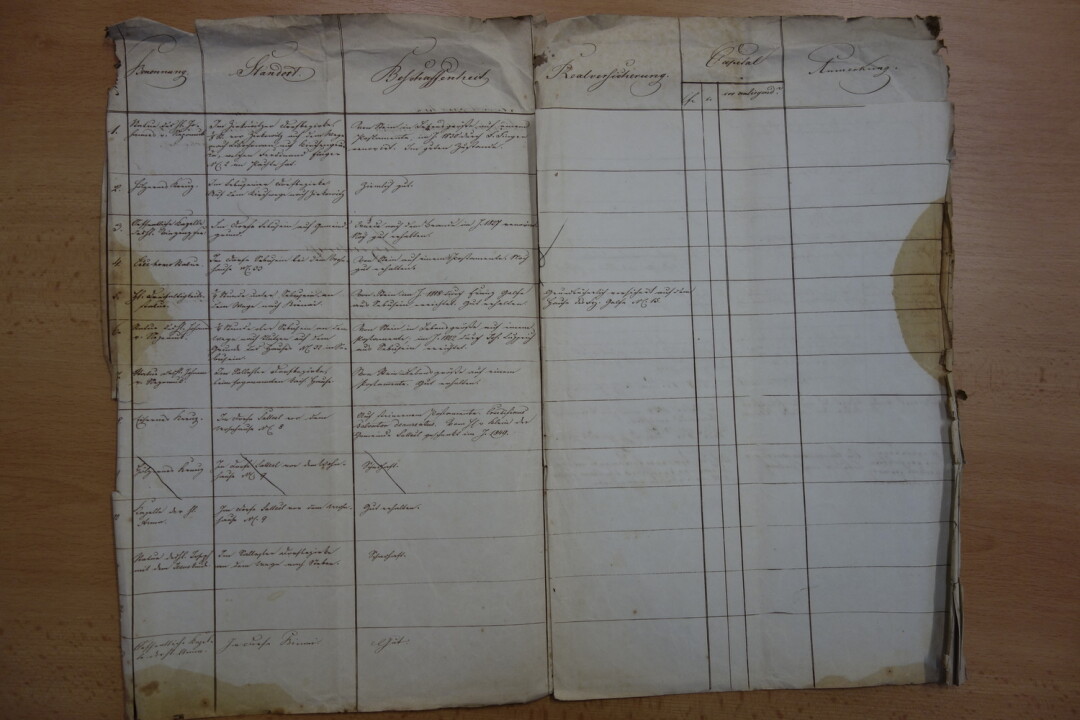
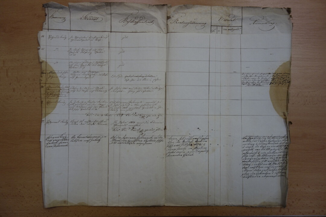
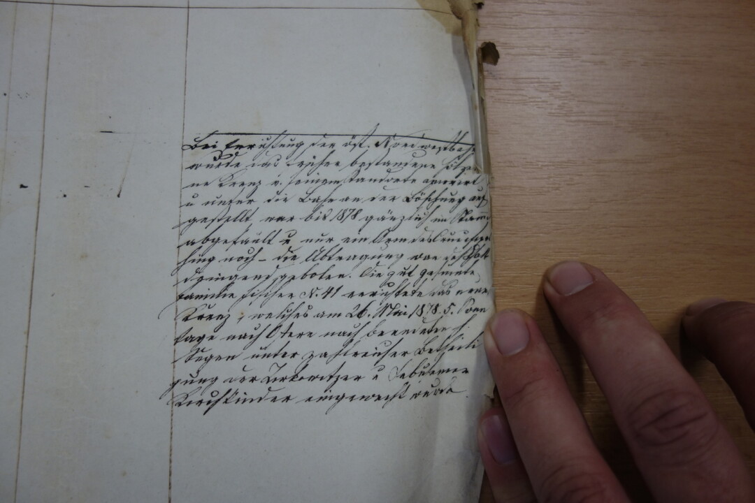
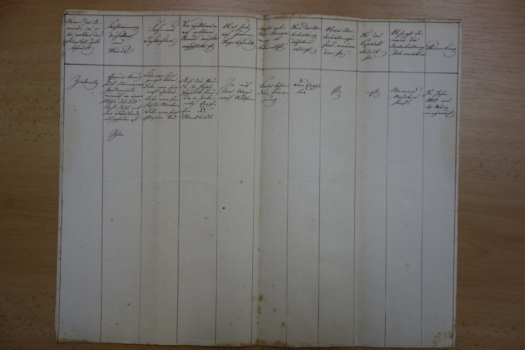
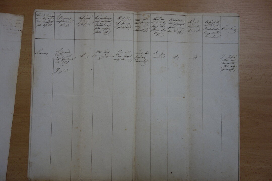
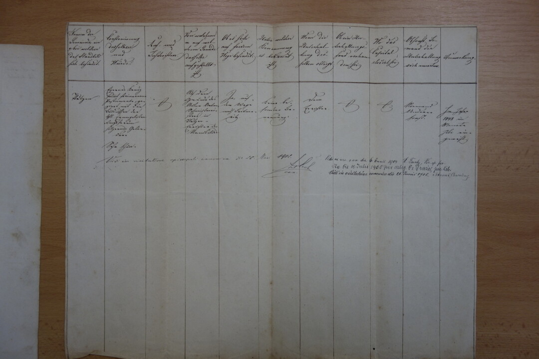
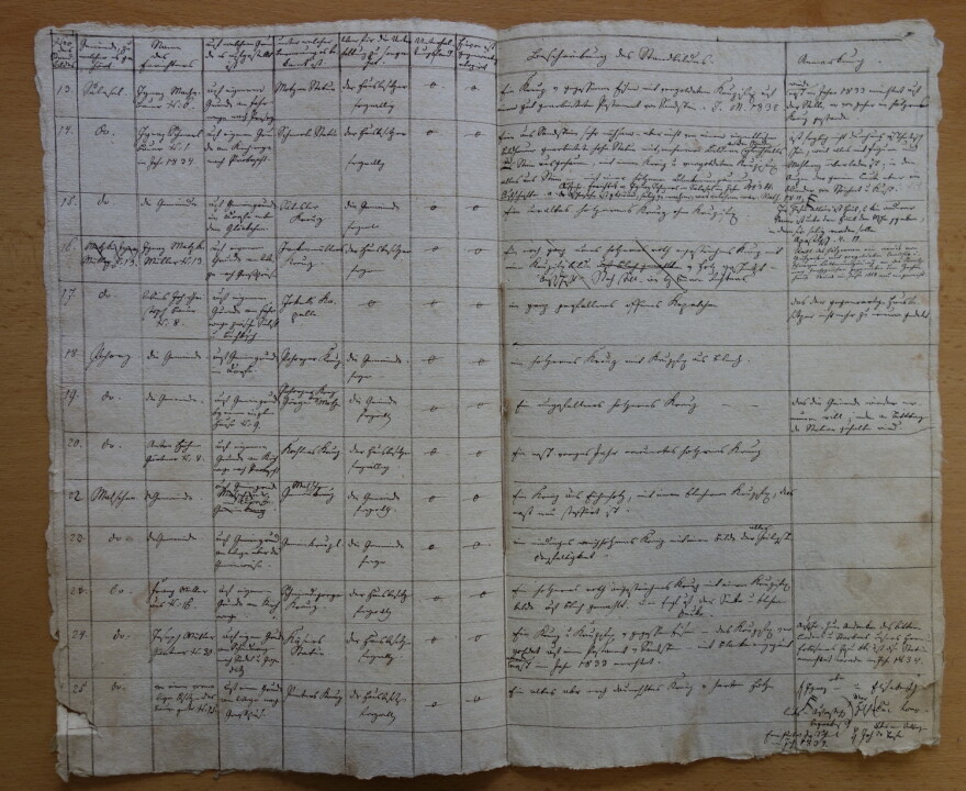
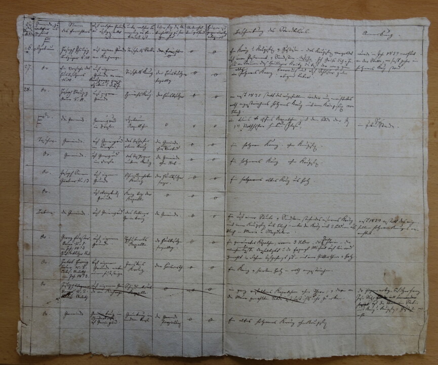
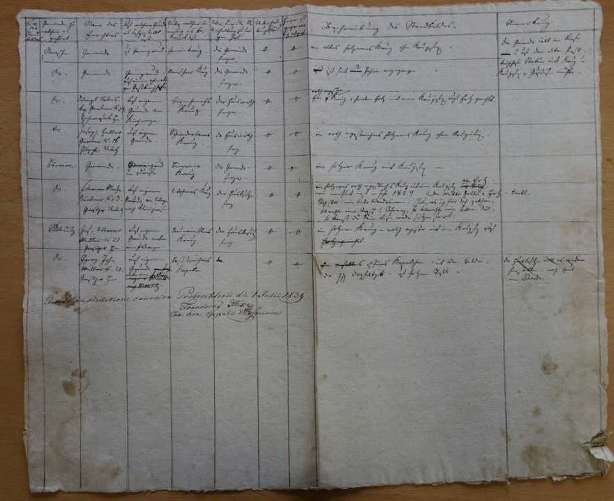
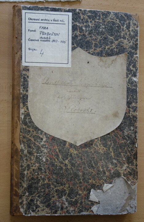
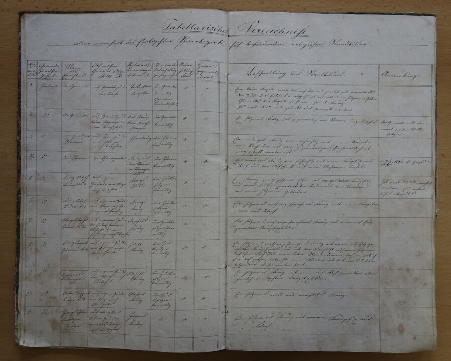
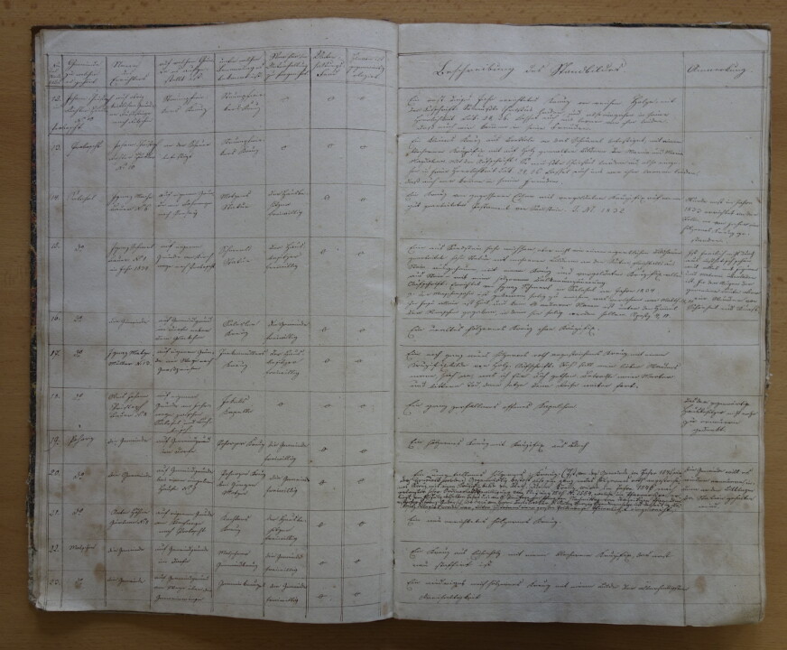
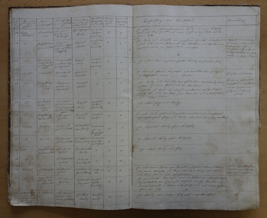
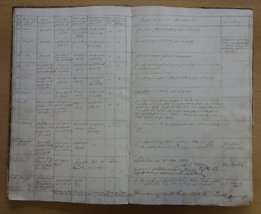
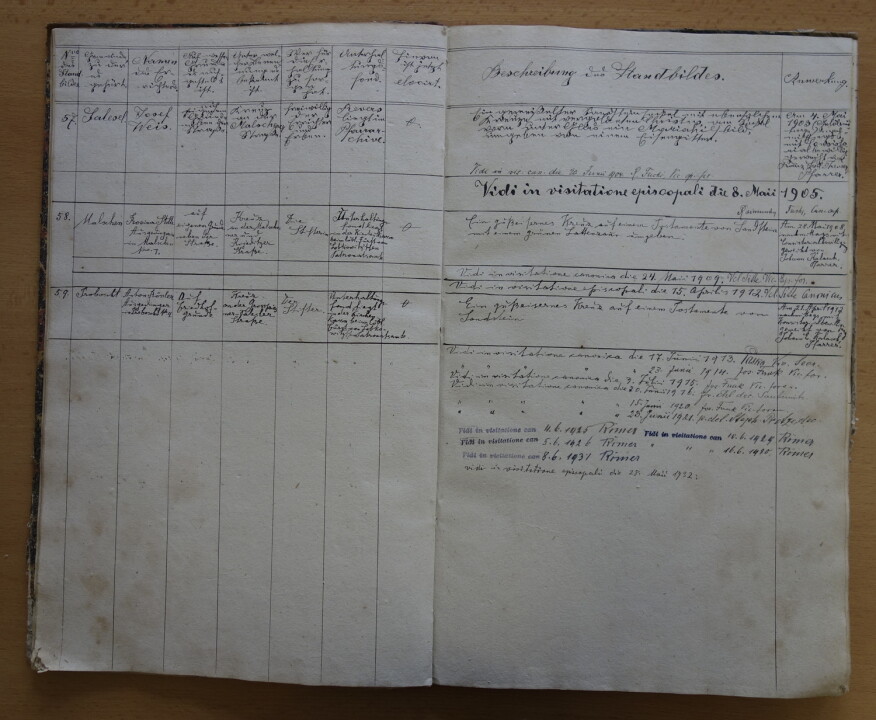
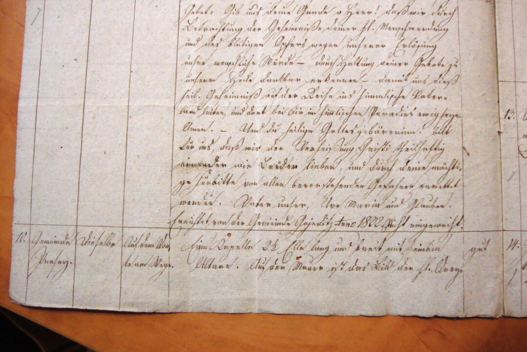
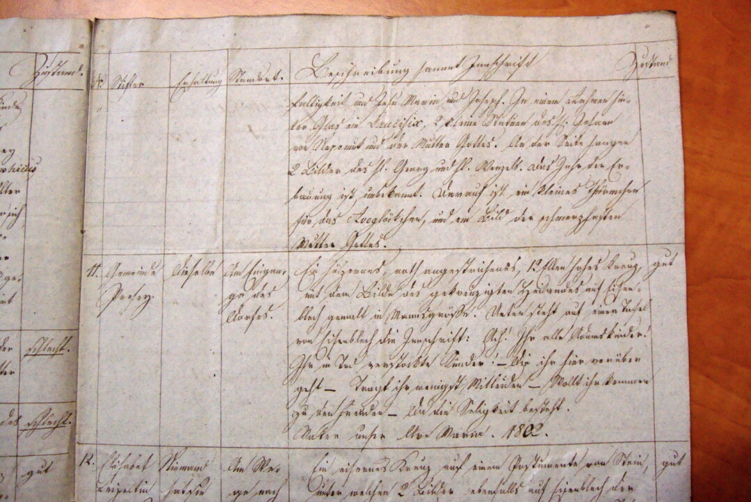
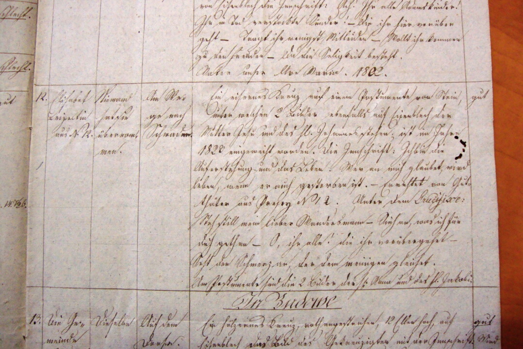
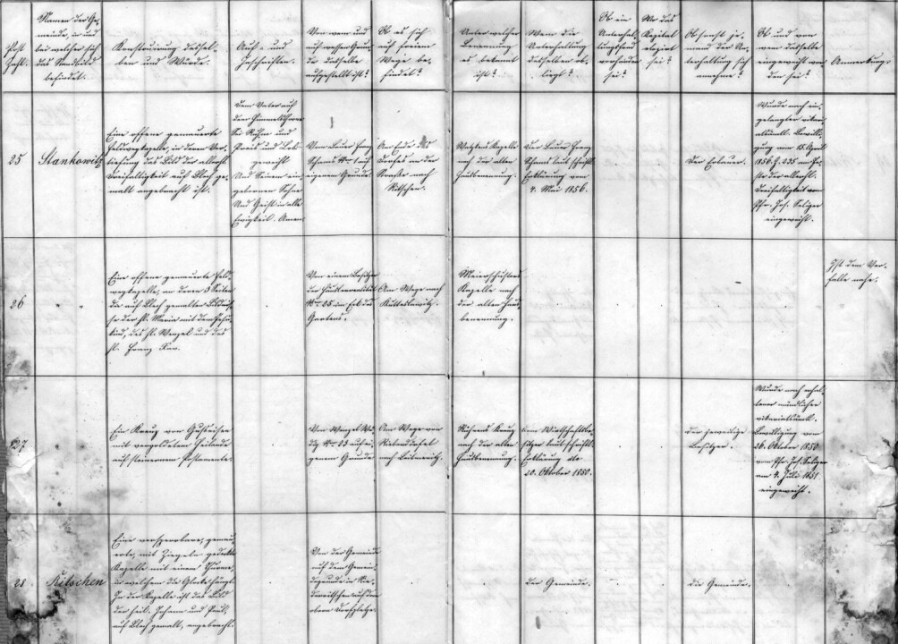
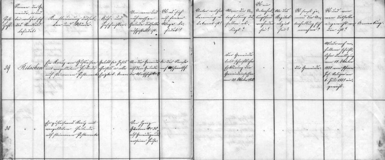
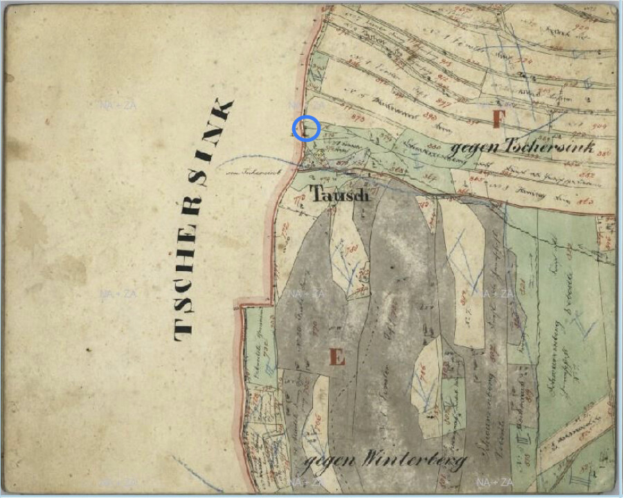
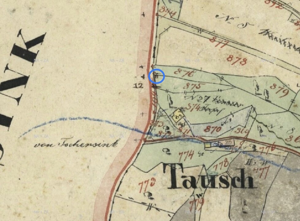
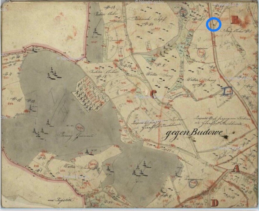
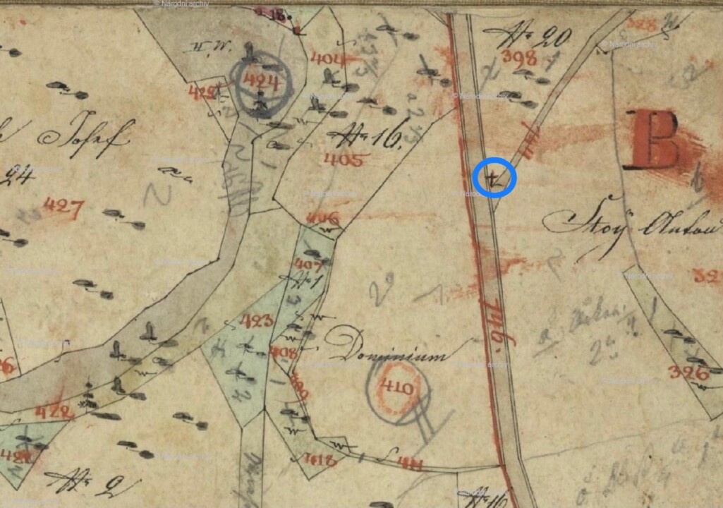
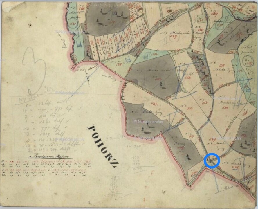
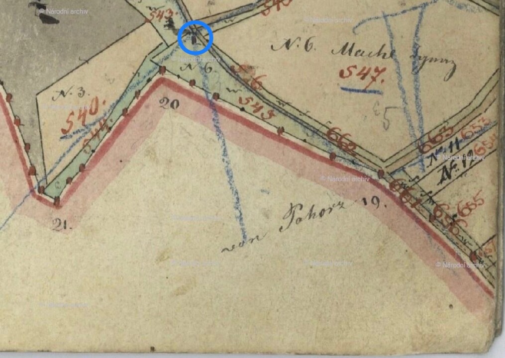
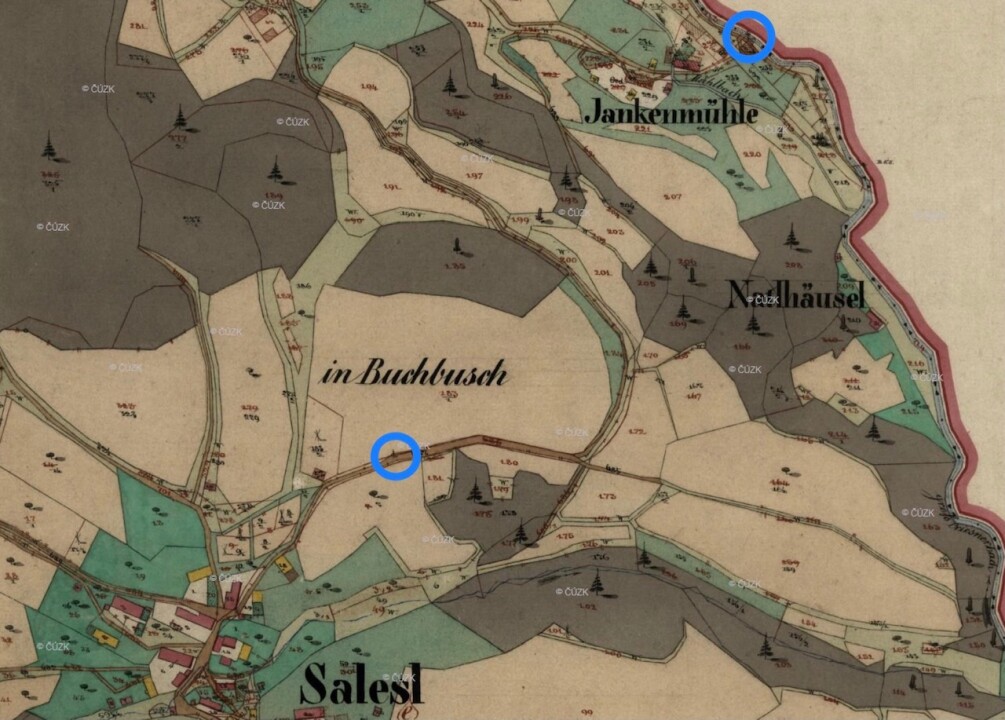
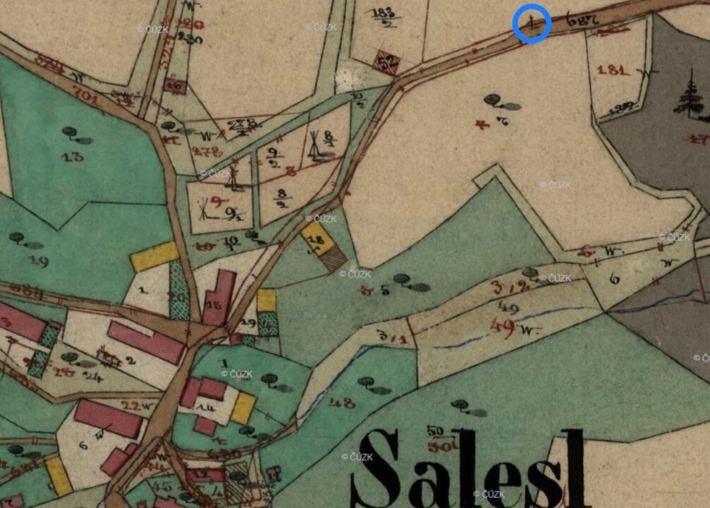
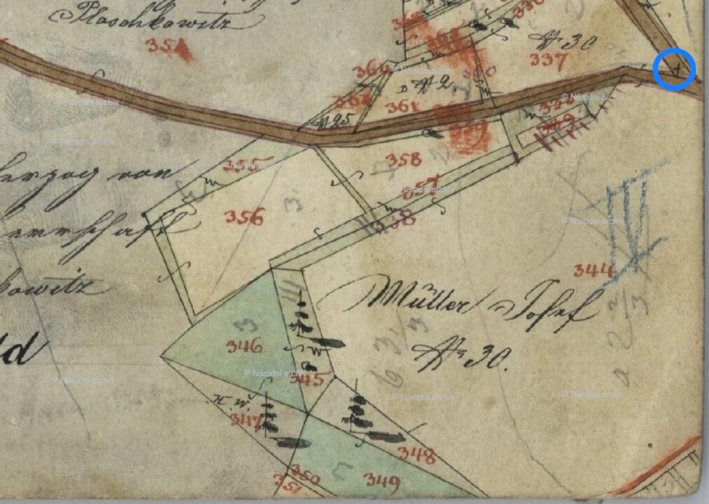
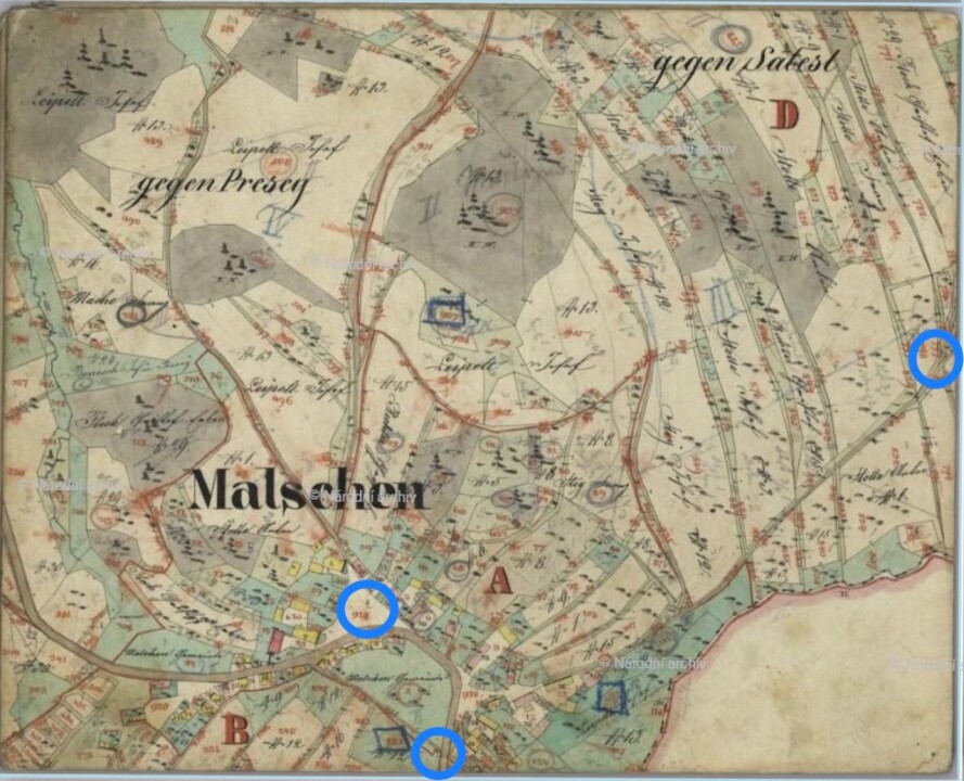
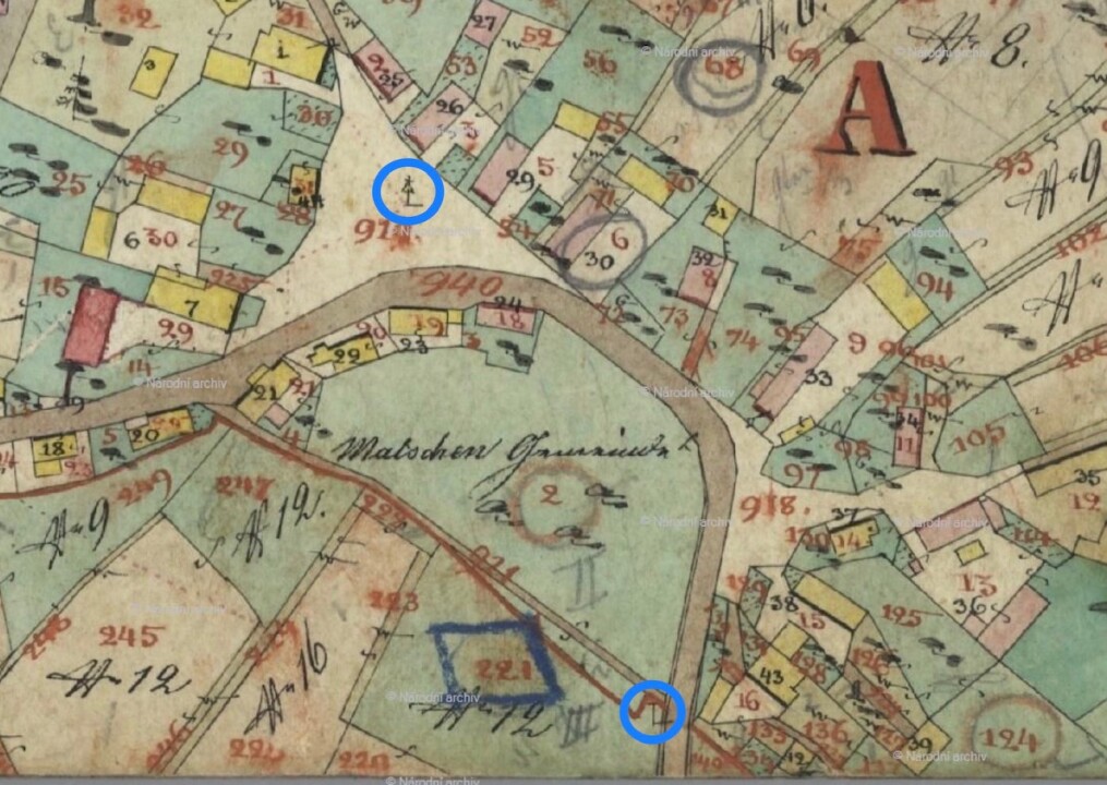
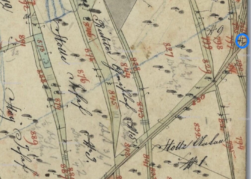
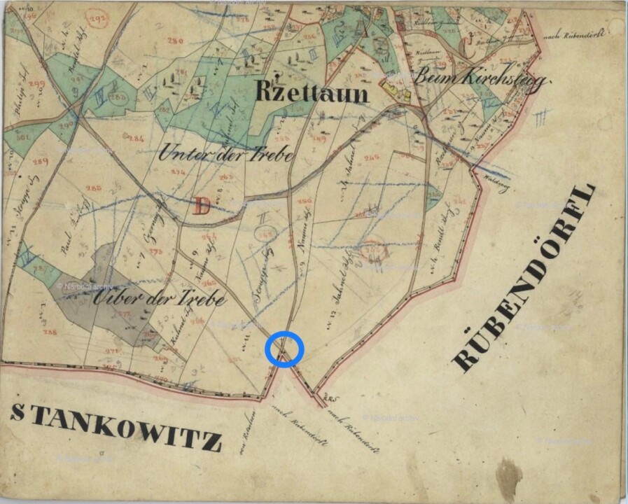
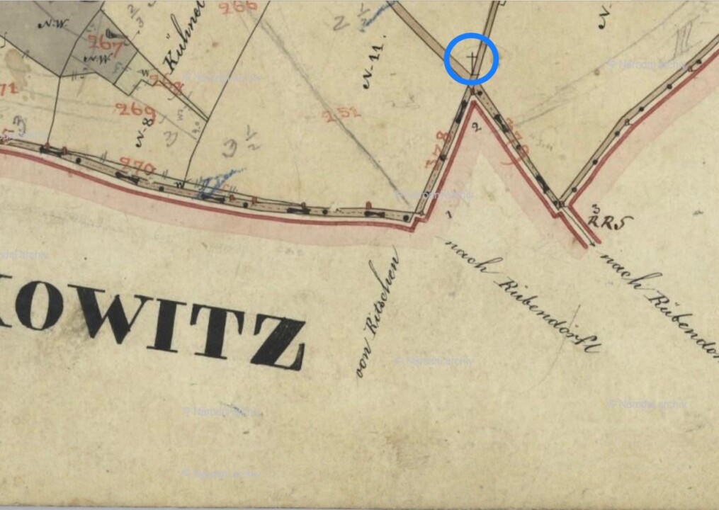
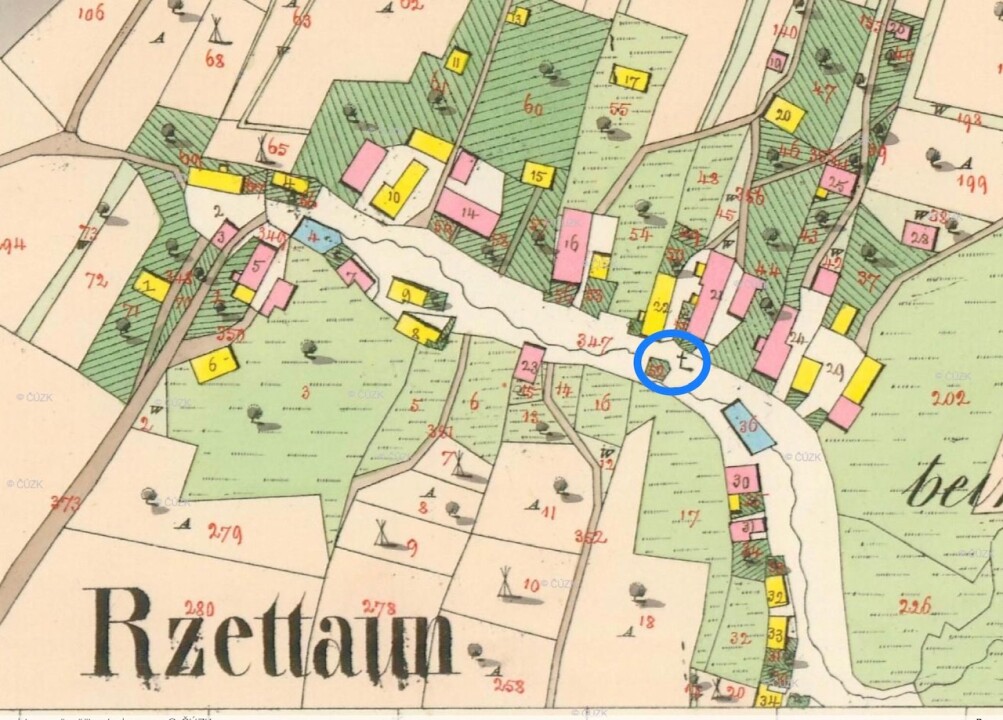
The historical records consist of inventories compiled and maintained by the respective parish offices in the 1930s and later years of the 19th century, and in some cases, also in the early 20th century. The reproductions of archival materials shown here are published with the permission of the Bishopric of Litoměřice. The original archival materials are held by the Roman Catholic parish of Proboštov, the Roman Catholic parish of Třebušín, the Roman Catholic parish of Církvice, and the Roman Catholic parish of Svádov. Translations into Czech were provided by an expert from the National Heritage Institute.
Click on the corresponding inventory to view individual sheets.

FÚ Svádov - translation

FÚ Proboštov - translation

FÚ Církvice - translation

FÚ Třebušín - translation

Military Mapping

Other historical sources include maps from the so-called First, Second, and Third Military Mapping. The following text is taken from the Methodology.

The First Military Mapping, also known as Joseph’s Mapping, was created in the Czech lands between 1764 and 1768 and was supplemented and refined between 1779 and 1783. As the name suggests, the mapping was carried out for military purposes, aiming to capture the entire territory of the then Habsburg Monarchy. The mapping was based on older sources (in the case of the Czech lands, from Müller's mapping), conducted at a scale of 1:28,800, and accompanied by extensive textual material. The originals of the map sheets and accompanying texts are held in the Austrian State Archive – Military Archive in Vienna. Digitized map sheets are available online on the web portal of the Laboratory of Geoinformatics of the Faculty of Environment, UJEP Ústí nad Labem at http://oldmaps.geolab.cz. Small monuments were recorded for military purposes as valuable landmarks in the landscape. Although the number of depicted objects cannot be considered a complete inventory of existing monuments, it provides some insight into the distribution, frequency, and partially the typology of small monuments in our territory. Small monuments are consistently represented here by the symbol of a cross (red indicating a stone or brick object) or the symbol for a chapel.

© 1st Military Survey, Section c026a, Austrian State Archive/Military Archive, Vienna

© Laboratory of Geoinformatics, J. E. Purkyně University – http://www.geolab.cz

© Ministry of the Environment of the Czech Republic – http://www.env.cz

The Second Military Mapping, known as František’s Mapping, took place in the Czech lands between 1836 and 1852 and was based on the trigonometric network established between 1806–1811 and 1816–1821. Where cadastral maps of the stable cadastre had already been created, they were used as a basis. Again, extensive descriptive material accompanied the entire project. Compared to its predecessor, this mapping is cartographically more accurate. Small monuments are depicted using the same symbols as in the First Military Mapping. Map sheets at a scale of 1:28,800 in digital form can also be found on the previously mentioned website http://oldmaps.geolab.cz.

The marking of small religious monuments here is not nearly as clear (and their number is not complete) as in the First Military Mapping, where these monuments played a much greater role for the map compiler and the subsequent user in refining location and orientation.

© 2nd Military Survey, Section c026_W_4_I and c027_O_4_I, Austrian State Archive/Military Archive, Vienna

© Laboratory of Geoinformatics, J. E. Purkyně University – http://www.geolab.cz

© Ministry of the Environment of the Czech Republic – http://www.env.cz

The Third Military Mapping, known as the Francis-Joseph Mapping, was created for the Czech lands between 1876 and 1879. Its primary output consisted of colored maps of the so-called topographic section at a scale of 1:25,000, from which special maps (1:75,000) and general maps (black and white, 1:200,000) were derived. After the collapse of the Austro-Hungarian monarchy in 1918, the mapping outputs were taken over by the successor states. In our country, special and general maps were published in a modified and updated version until the 1950s. This mapping is considered quite accurate. The legend distinguishes various symbols, such as a chapel, monument, cross, wayside shrine, or other ritual objects, and even images on trees. The maps of the topographic section also differentiate whether the monument is made of stone or brick (red) or wood (black). Part of the original map sheets of the topographic section at a scale of 1:25,000 is lost, but the special maps are fully available. Both are accessible in digital form on the previously mentioned website http://oldmaps.geolab.cz.

© Ministry of Defence of the Czech Republic

© Laboratory of Geoinformatics, J. E. Purkyně University – http://www.geolab.cz

Indication Sketches of the Stable Cadastre

The last fundamental historical map source is the stable cadastre, specifically the so-called indication sketches of the stable cadastre and its imperial obligatory prints. The following text is taken from the Methodology.

The mapping of the stable cadastre was initiated by the imperial patent of 1817, which mandated the creation of a new cadastre recording all land in the Austrian Empire, including its area and yield subject to land tax. Measurements based on the trigonometric network were carried out in Bohemia between 1826–1830 and 1837–1843, and in Moravia between 1824–1830 and 1833–1836. The output consisted of cadastral maps at a scale of 1:2880, separately for each cadastral municipality. Copies of the original cadastral maps of the stable cadastre, created during field surveying, were made by patent for storage in the Viennese archives—these are the so-called imperial obligatory prints. Additionally, colored maps were derived from the original maps for further fieldwork to record (indicate) changes, known as indication sketches. The originals of the indication sketches for the Czech lands are stored in the National Archives in Prague, the Moravian Provincial Archives in Brno, and the Provincial Archives in Opava. The imperial obligatory prints are kept in the Central Archive of Surveying and Cadastre, which has made them available in digital form on its web portal http://ags.cuzk.cz/archiv. A significant portion of the indication sketches is also available here, allowing for a comparison of both map sources. The legend of the imperial obligatory prints distinguishes small monuments with symbols for wayside shrines, chapels, crosses, milestones, and boundary markers. The material of construction is again distinguished by color—red indicates stone or masonry, while black represents wood.

The stable cadastre was revised in subsequent years, and after World War I, it became the basis of the land cadastre, which is also the foundation of the current land registry of the Czech Republic.

The mapping of the stable cadastre for all parts of the Malečov region took place in 1843. Below, the Stable Cadastre Indication Sketches are displayed for each section—first, the entire map, followed by a cropped section of it. If an original map or an imperial obligatory print was used to identify a small sacral monument, this fact is noted in the map caption.

Tourist Maps, Guides

Older tourist maps or guides can also be a valuable source of information, as they may include small sacral monuments that have partially or completely disappeared. Even existing tourist maps (e.g., see mapy.cz), since they draw information from older sources, capture the location of many of these monuments.

Iconographic Documents

In addition to information from specialist literature, maps, and written sources, all iconographic documents related to the documented object are of irreplaceable importance. These include historical postcards, vedutas, drawings, plans, and especially photographs. All historical photographs presented here come from the archive of the Museum of the City of Ústí nad Labem.

Unpreserved Monuments

E.g., the chapel in Němčí, which is already visible on the maps of the Second and Third Military Mapping and also on the tourist map from 1934. In the current land register, plot No. 5, where the chapel stood before its demolition in 1970, is listed as a demolition site. Other examples of vanished monuments include the chapel in Malečov, which stood by the road below the present fire station, or the chapel in Rýdeč.

Other Documents

Other sources of information include primarily works of art historical inventory literature, historical topography, archives of relevant estates, regional periodicals, etc. Findings from such sources, if related to small sacral buildings in the Malečov region, will be gradually published here.

Nastavení soukromí a cookies

Webové stránky používají k poskytování služeb, personalizaci reklam a analýze návštěvnosti soubory cookies.

Následující volbou souhlasíte s našimi zásady ochrany osobních údajů a cookies. Svá nastavení můžete kdykoli změnit.